
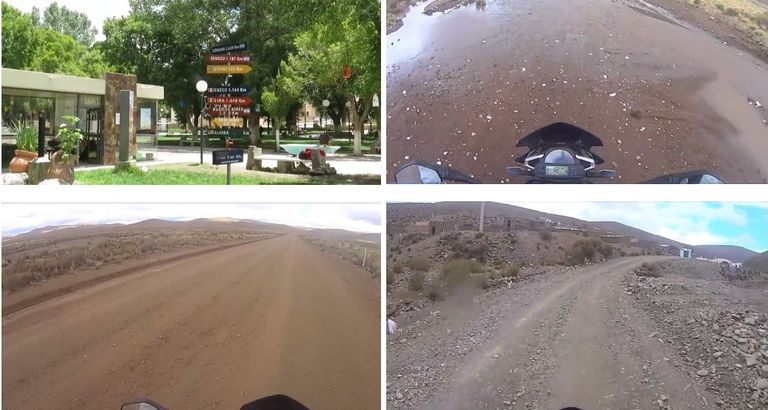
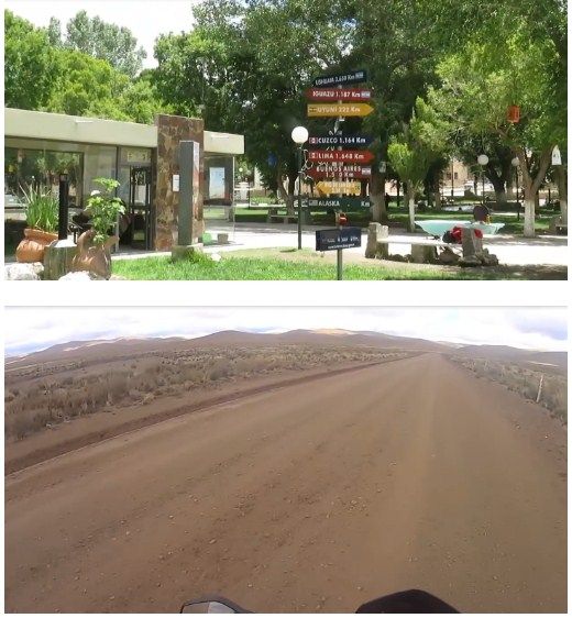
The great journey of Route 40: the first stage, La Quiaca-San Antonio.

The most famous route in Argentina is Route 40. Five years ago I made this journey. And today I will tell you. With a previous introduction in this same Community.
In La Quiaca there is a continuous exchange of merchandise in general in the large open-air market. From groceries to toys.
The great journey of Route 40, the first stage: from La Quiaca to San Antonio de los Cobres.
It is a continuous flow of people who give from one side to another. From one country to another.
In the center of the city, trying to give an image of peace and tranquility, the imposing figure of the church predominates.
People are simple and friendly. Time runs slowly. No one rushes. No one constantly watches the clock like we do in big cities.
Time seems to have stopped.
The people of La Quiaca have indigenous blood.
The hustle and bustle in the courtyard of the Villazón La Quica border is hellish.
Each passenger's baggage is thoroughly checked. And the time to pass is getting longer.
After completing all the bureaucracy of the immigration office, we can finally leave. Free way!
We crossed (me and my motorcycle) the bridge over the dry river of La Quiaca that separates or divides both countries.
The dispute of this font led in the past to many rivalries and fights between the two South American countries.
Until not long ago a train arrived.
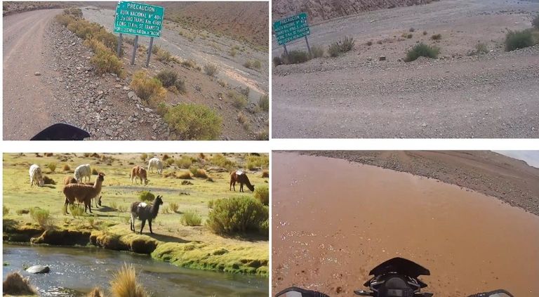
This part of Route 40 starting from the north is one of the parts not yet paved. The gravel and the uncompacted soil put my bike to the test.
And it has that copper color that characterizes The Puna.
Continuous descents and ascents that, despite appearing bleak, have their charm.
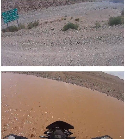
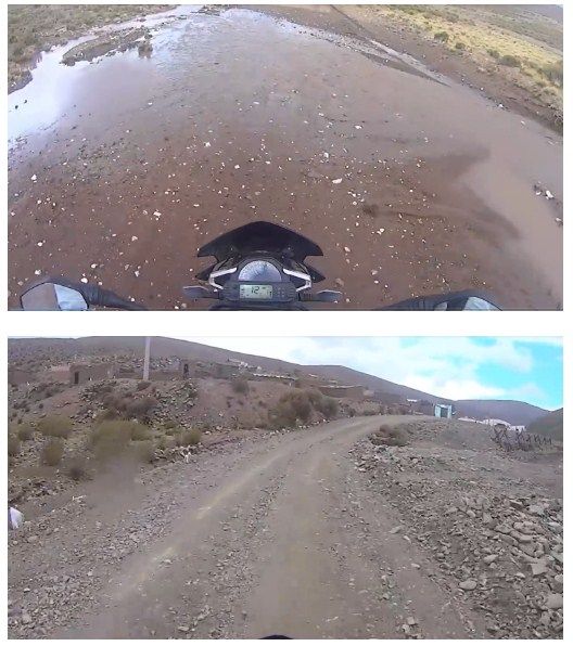
Despite the fact that the climate is arid and semi-desert, traveling in summer we come across some lagoons and puddles that are the result of recent rains.
The time when it rains the most is from October to March.
The wind is cold and strong. For this reason almost all the doors and windows of the houses are always closed. It is not out of fear but to prevent the entry of dirt and dust into the houses. And it contrasts with the hospitality of the people.
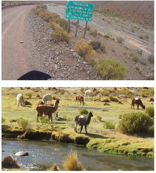
Warnings intended to travel with caution along the dirt roads are quite common.
And finally I see the first signs of animal life: the typical animal flames and symbol of the Puna jujeña.
People don't know you but greet you as you pass.
People who appreciate the spirit of the traveler and his desire to know.
Here we are 11 kms above the bed of the Paicone gorge.
These lands seem out of the palette of a painter. And in fact that is the name of one of these multi-colored hills. Here, evergreen flowers are cultivated and there are some works of rock art.
Sometimes the colors of La Puna seem to merge into the very color of the territory, with its muddy towns and its people without haste.
People have also learned to live from tourism. You can trek on cobbled paths or travel with a caravan of llamas.
The unevenness of the route, the gravel, and the unconsolidated land require continual warnings.
Route 40 to the north crosses the bed of several rivers and cuts for 11 km the bed of a dry creek. The cardons are in bloom.
There are no noises or cares. There are no advertising or shopping malls. Not politicians or banks.
Here the soul calms down and the heart recovers reason.
I spend the night in a school at 3,800 meters high. It is cold but the spirit is warm to start the second stage.
I arrive at San Antonio de los Cobres
I have traveled 444 kms on my first day, on a gravel road, crossing ravines, lagoons, ups and downs with the witness hills, without services for the traveler, service stations or lodging.
I hope you enjoyed this book. If you have any questions, or want to supplement this post, please write in the comments area. You can also visit Facebook, Twitter, Linkedin, Instagram, Pinterest and Feedly where you'll find further information in this blog. SHARE THIS!


The Route 40 route is an epic journey of more than 5,000 kilometers that crosses the entire length of Argentina, from south to north, parallel to the Andes Mountains, from Cabo Vírgenes in Santa Cruz to La Quiaca in Jujuy. It offers diverse landscapes that include Patagonia, the Andes, and the Northwest, with highlights such as the Seven Lakes Route, Cuesta de Miranda, and Abra del Acay, combining stunning nature with rich local culture.
ReplyDeleteThe legendary National Route 40 crosses our country from south to north, with its kilometer 0 at the southern tip of the continent in Cabo Vírgenes, Santa Cruz. It runs parallel to the Andes mountain range and reaches La Quiaca in Jujuy, totaling approximately 5,000 km and connecting 11 provinces.
Delete