If you like hiking and you are traveling in a place surrounded by mountains, you are not likely to get bored. Even if you think you've done everything interesting, there will always be more to do. During my travel days in the city of Ushuaia, I went for a walk almost every afternoon, which allowed me to see the touristy places as well as the not so touristy ones. I liked this because I could have the most classic postcards of the place, but also those that usually visitors do not know. This is the case of the landscape that can be seen from the summit of Mount Susana, perhaps not so well known but worth knowing .


Pinmapple (18x12) (25).png


One of the things I liked most about Ushuaia, unlike the rest of the places I've been, is that there was Uber service. This travel platform allows cheap transfers, even at half price compared to regular cabs. Since there are not so many public bus networks in the city, having this option was very useful to get to those places that cannot be reached on foot. Also, there were evenings when I was alone, like this day, so I had to pay for a whole trip on my own, but with Uber it was not so expensive .

IMG_20231212_145958131~2.jpg IMG_20231212_150004894.jpg IMG_20231212_150822460~2.jpg IMG_20231212_151443979.jpg


After checking where to go, I decided on Monte Susana, whose trailhead is located 5 km from the city center. For this trip I had paid about $5 and arrived in less than 10 minutes, which seemed more than affordable and a good plan for my day. The thing is that in that area I had no signal and I didn't know how I was going to ask for a car to go back, but I thought "5 km more in addition to the hike I have planned, it won't be a big problem" .

IMG_20231212_151846393.jpg IMG_20231212_161210691~2.jpg IMG_20231212_151106246~2.jpg IMG_20231212_150105732.jpg


You could tell that this mountain was not so touristy from the moment you arrived and all its signage was lying on the ground. At least they left it there and didn't take it down, because I helped myself with that to get my bearings. In the first part of the road there was a path that shortened the path of the cars and had a fairly significant slope, so you gained altitude quickly. Significant unevenness always means great demand for the legs, but this was later compensated with a gradual ascent inside the lenga forest .

IMG_20231212_152040750~2.jpg IMG_20231212_152726676.jpg IMG_20231212_154609212.jpg IMG_20231212_154604303~2.jpg


Although the path was marked with yellow signs, the trail was not very well trodden so you had to move carefully. In all this stretch I did not come across absolutely no one, which gave an idea of how little visited the place was. When I finally reached the viewpoint I had planned, I sat down for a while to rest, even though I had been walking for just over an hour. At this viewpoint there was a seat where you could sit and contemplate the scenery ❣️.

IMG_20231212_164510000~2.jpg IMG_20231212_164506733~2.jpg IMG_20231212_164633146~2.jpg


Ushuaia is really beautiful: the southernmost city in the world began as a small village for the most dangerous prisoners in the country and years later became this incredible tourist place. What amazed me most about this viewpoint is that you could see the entire peninsula where the city's airport is located, parallel to it. You can also see from there what was the old airport, perpendicular to the city. In the early years, airplanes had to take off and land passing over the city and in a much smaller space for maneuvers, which caused several accidents. The new runway looks noticeably larger and now the planes arrive over the Beagle Channel, without flying over the urbanization .

IMG_20231212_164629634~2.jpg IMG_20231212_164856772~2.jpg IMG_20231212_170201492~2.jpg IMG_20231212_164502410~2.jpg IMG_20231212_170204838~2.jpg IMG_20231212_170155485~2.jpg


After sitting there for a while, the first person I saw all afternoon appeared, after the Uber driver. It was Patricia, a woman who was also traveling alone because "her husband does not like to travel and she was not going to stay without seeing Ushuaia". We quickly became friends, as with those people with whom there is a good vibe from the moment. We chatted a bit about why she decided to go to this not so touristy place and she told me that it was because 600 meters above sea level seemed easy for someone who does not walk regularly and that was the case, because she got there without any problems .

IMG_20231212_164453694~2.jpg IMG_20231212_164517316.jpg IMG_20231212_170628095~2.jpg IMG_20231212_173706681~2.jpg IMG_20231212_173350683~2.jpg


From the amount of rocks that were piled up very close to this viewpoint, I knew that many people made this place "their summit". When you got to this part, everything looked pretty flat, but if you looked in the direction of the Chilean border, you could see what the real summit was. Patricia also wanted to go to the summit, so we both continued on our way a little further. In this part, the trail was no longer well marked, but there was only one direction to continue ascending so we went and in less than half an hour we reached the real summit .

IMG_20231212_172802607~2.jpg IMG_20231212_173823140~2.jpg IMG_20231212_173736166~2.jpg IMG_20231212_173357681~2.jpg IMG_20231212_172814381~2.jpg IMG_20231212_174300752~2.jpg


Unfortunately we could not stay long because it was too windy, but we had good views of the Beagle Channel, Tierra del Fuego National Park and some snow-capped peaks already belonging to our neighboring country. Before going there I had investigated that there was another way down from the mountain towards the park, but with Patricia we concluded that we would go back the "same way". Well, I don't know what happened, but we got a bit lost in the forest and ended up going down a different trail than the one we both took at the beginning. The important thing is that when you are coming down a mountain, whenever you are descending you always get to the street level even if you take a longer path, and that's how it was .

IMG_20231212_182701879~2.jpg IMG_20231212_182121522~2.jpg IMG_20231212_182118328~2.jpg IMG_20231212_190026197~2.jpg IMG_20231212_191718851~2.jpg


Luckily for me, my new companion was another regular user of the "hitchhiking" mode, so this is what we did to get back to the city. Within minutes of getting off, a man and his son got us to the center faster than we thought possible. This allowed Patricia and I some extra time to stop by a bar for a few beers. It may not have been so fit on our part, but at least we had gotten enough exercise during the day in the Susana Mount .

source

Here’s a 2‑day adventure itinerary in northern San Juan focused on rafting and windsurfing, with photos and details to inspire your trip:

️ Day 1 – Rafting the Jáchal River

  • Morning: Guided rafting excursion through the canyon. Rapids range from Class II to IV, offering adrenaline and scenic views.

  • Afternoon: Picnic by the riverbanks, with options for fishing or short hikes.

  • Evening: Return to San José de Jáchal for dinner featuring local dishes like cabrito or empanadas.

  • La Morada Aventura – Rafting rio Jáchal, Pesca embarcado dique Punta ...

  • San Juan y la Ruta 40

  • Rafting en el Cañón del Río Jáchal, importante punto turístico al norte ...

️ Day 2 – Windsurfing at Cuesta del Viento Dam

  • Morning: Windsurfing lessons or free sailing at the Cuesta del Viento Dam, renowned for strong, steady winds.

  • Afternoon: Kitesurfing or kayaking for variety. The desert‑mountain scenery makes for spectacular photos.

  • Evening: Sunset by the dam, then return to Jáchal for a relaxed evening.

  • Windsurf en la Cuesta del Viento, San Juan

  • Dique Cuesta del Viento, San Juan

  • Windsurfing, Cuesta del Viento, San Juan, Argentina. | Lugares

Practical Tips

  • Best season: October–March for rafting; windsurfing is year‑round.

  • Gear: Bring quick‑dry clothing, sunscreen, and waterproof cameras.

  • Base: San José de Jáchal is the hub for both sports, with lodging and tour operators.

      Argentina is a land of dramatic contrasts, ranging from the subtropical jungles of the north to the glacial landscapes of the deep south. While the country has faced economic shifts recently, it remains one of the top travel destinations in South America.

      The most visited tourist destinations in Argentina are categorized below by their primary appeal:

      1. The Big Three (The "Must-Sees")

      These three locations form the core of most international itineraries:

      • Buenos Aires: The cosmopolitan capital is the primary gateway for most travelers. Known as the "Paris of South America," it attracts millions of visitors annually with its European architecture, vibrant tango culture, and world-class dining in neighborhoods like Palermo, San Telmo, and Recoleta.

      • Iguazú Falls: Located on the border with Brazil, these falls are one of the New 7 Wonders of Nature. The Argentine side offers an extensive network of walkways, including the famous "Devil’s Throat" (Garganta del Diablo).

      • Perito Moreno Glacier (El Calafate): Situated in Los Glaciares National Park, this is one of the world's few advancing glaciers. Visitors come to witness massive chunks of ice "calving" into the turquoise waters of Lake Argentino.


      2. Regional Highlights

      Depending on the season, these regions see high volumes of both domestic and international tourists:

      Region
      Key Destination
      Why People Go

      Patagonia
      Bariloche
      The "Lake District" is famous for its Swiss-style architecture, chocolate shops, and world-class skiing at Cerro Catedral.

      Cuyo
      Mendoza
      The heart of Argentina’s wine industry. It is the go-to spot for Malbec tastings and trekking near Aconcagua, the highest peak in the Americas.

      The North
      Salta & Jujuy
      Known for colorful mountains (The Hill of Seven Colors), salt flats (Salinas Grandes), and rich indigenous heritage.

      The South
      Ushuaia
      Often called the "End of the World," it is the southernmost city on Earth and the primary departure point for Antarctica cruises.


      3. Notable Mentions

      • El Chaltén: Widely considered the "Trekking Capital of Argentina," located near El Calafate. It’s a paradise for hikers looking to see the iconic peaks of Mount Fitz Roy.

      • Mar del Plata: This is the primary beach destination for locals. While not always on the international radar, it sees massive crowds during the summer months (January and February).

      • Puerto Madryn: The best place for wildlife enthusiasts, specifically for whale watching (June–December) and visiting one of the world's largest penguin colonies.

      Travel Tip: Argentina is massive. If you're planning a trip, keep in mind that flying between these destinations (e.g., Buenos Aires to Ushuaia) takes several hours, as bus travel can take days across the vast Patagonian plains.

      Departamento Jáchal - Wikipedia, la enciclopedia libre

      Here is the translation of the guide to the northern region of San Juan Province:

      The north of San Juan Province offers some of the most striking, remote, and photogenic landscapes in Argentina, featuring high-altitude deserts, turquoise reservoirs, and historic mountain oasis towns.

      The top places to visit in northern San Juan, along with their key photo details and distances from the provincial capital, include:

      1. San José de Jáchal
      • Distance from San Juan City: ~160 km north (approximately a 2-hour drive via Ruta Nacional 40).

      • Photo & Landscape Details: One of the province's most traditional cities, ideal for capturing colonial adobe architecture, narrow streets, and the historic Church of San José. In the surrounding areas, you can visit ancient stone-and-wood flour mills nestled within arid agricultural valleys.

      2. Cuesta del Viento Reservoir (Rodeo)

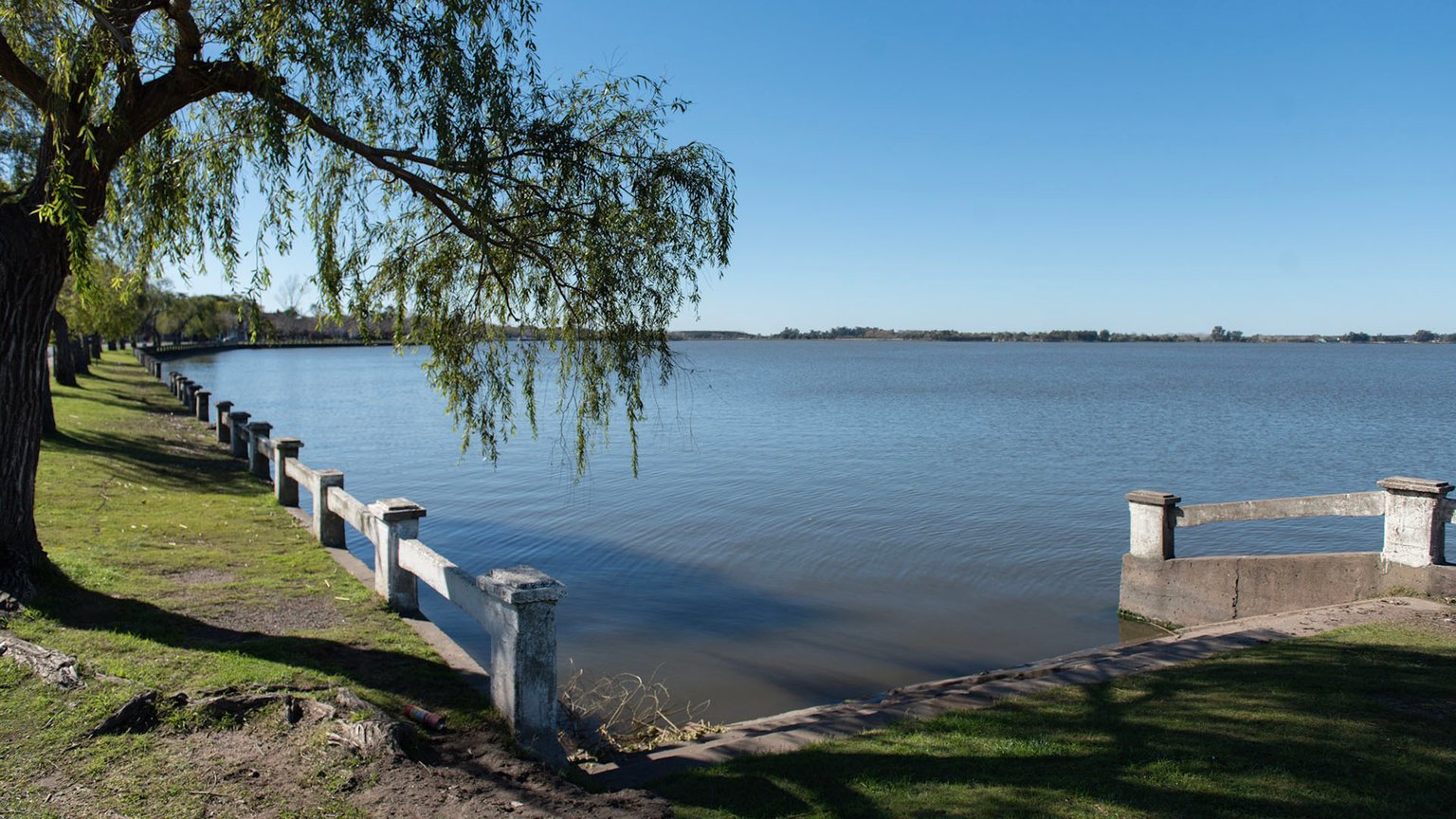
      Islas Griegas en el Dique Cuesta del Viento No son islas de Grecia  Se  llaman así a un grupo de islotes dentro del *Dique Cuesta del Viento*, en  Rodeo, Departamento Iglesia,

      • Distance from San Juan City: ~180 to 200 km northwest (taking RN 40 to Jáchal, then connecting via Ruta Nacional 150 toward Rodeo).

      • Photo & Landscape Details: A stunning body of water with an intense turquoise-blue color that contrasts sharply against arid, reddish mountains. In the morning, the water often acts as a mirror reflecting the peaks; in the afternoon, strong winds attract kitesurfers and windsurfers, making it great for dynamic shots with colorful sails against the desert backdrop.

      3. Cuesta de Huaco

      Conocés la cuesta de Huaco en San Juan? ✨  Argentina está llena de  rincones sorprendentes y la Cuesta de Huaco, en la provincia de San Juan,  es uno de ellos. ️

      • Distance from San Juan City: ~190 km north (about 30 km northeast of Jáchal).

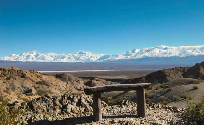
      • Photo & Landscape Details: This winding, highly photogenic mountain road snakes through impressive geological folds and stratified rock walls. It leads down into the peaceful village of Huaco, famous for its adobe walls, centennial weeping willows, and the old historic flour mill.

      4. San Guillermo National Park (Parque Nacional San Guillermo)

      Parque nacional San Guillermo - Wikipedia, la enciclopedia libre

      • Distance from San Juan City: ~350+ km north (accessed from the Rodeo/Iglesia area, requiring a 4x4 vehicle and an authorized guide).

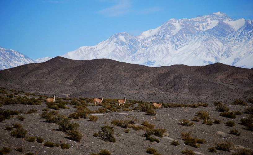
      • Photo & Landscape Details: Located deep in the high Andes at over 3,000 meters of altitude, it protects vast, sweeping high-desert plains. It is the premier spot in Argentina to photograph large herds of wild vicuñas and guanacos roaming freely under crystal-clear skies.

      With this type of travel, where you plan to stay a little longer than usual, it is possible to get to know places that would otherwise have gone unnoticed. Each new city I visit has its own charm, and I like to have enough time to visit as much as I can. During my stay in Esquel I had a lot of free time in the evenings, as I got a very good volunteer shift during the late evening hours. Taking advantage of this scheme, I walked around most of the city, visiting the most touristic places and those that are not so touristic .


      $1


      One of the most popular areas for tourists is the La Zeta Lagoon. This lagoon can be reached by vehicle, making it a good option for family outings and for getting to be in a beautiful place without making so much physical effort. Of course I love walking to places, so that's how a group of hostel guests and I got there. Autumn was approaching, so we wanted to make the most of the last days of good weather .

      IMG_20240312_165527351~2.jpg IMG_20240312_173053875~2.jpg IMG_20240312_165908991.jpg


      After staying in the lagoon for a while until the sun started to go down, we decided to walk a little further. The thing about southern Argentina is that in the afternoon the weather can be as hot as summer, but as soon as night falls, the temperature drops abruptly. To warm up a bit we chose one of the many trails around the lagoon, and one of them was the one that took you to the Plaza de los Mates .

      IMG_20240312_165941773~2.jpg IMG_20240312_173103300~2.jpg IMG_20240312_170056256~2.jpg IMG_20240312_172801981.jpg


      Of all the trails in this area, the one in this square is the shortest and takes only about 20 minutes. A short walk around the lagoon leads to a path that enters the forest and then comes out into a clearing with short grass, where there are some games for children and also a place to spread out. As for the name, it is called ‘de los Mates’ (of the gourds) because it has some gourds carved in wood distributed around the place. In case you don't know, a ‘mate’ is the drink made of yerba mate and hot water that we consume in Argentina, and the recipient in which this infusion is contained has the same name .

      IMG_20240312_170553987~2.jpg IMG_20240312_171828233~2.jpg IMG_20240312_170845019~2.jpg


      While I like quiet days with little walking and a relaxed atmosphere, from there I was already spotting the mountain I wanted to climb at some point during my stay. The highest mountain in Esquel is called Nahuel Pan, at over 2260 masl, and it was the one we could see from there. That big mountain looked like a physical challenge, and at that moment I felt emboldened to do it. I had done some research on how to climb it and I knew it wouldn't be an easy task, but it was my goal to reach the summit before I left (spoiler: a month and a half later that day, I made it to the top) ❤️.

      IMG_20240312_171201850.jpg IMG_20240312_173615303~2.jpg


      I liked Esquel so much that little by little the nostalgia of having left El Bolsón faded away and the excitement of getting to know more about a new city began to emerge in me. This nomadic trip took me to a lot of unthinkable places, but I liked it because I know that improvisation can also work. Before being in this corner of Chubut I didn't know much about it, but at that moment, seeing with my own eyes all the beautiful things it had to see and do, I knew it was a good decision to schedule a long stay there. And that was just the beginning ❤️.

      source

       
      Copyright © 2015 Argentina Photo Gallery
      Distributed By Gooyaabi Templates
      -->