F
Showing posts with label Itineraries. Mountains. Show all posts
Neuquén Seven Lakes

We did this trip in the fall of last year after going to Bariloche, in Río Negro. To get there we did the so-called "Road of the Seven Lakes", on Route 40. This route crosses almost all of Argentina (before this trip I had no idea about this). If you want to see more images of Route 40 and its landscapes, you can visit @patagonian-nomad's in HIVE blog, who made a great trip traveling it . 

Neuquén the capital of southern Argentina.

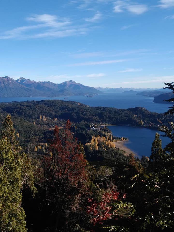
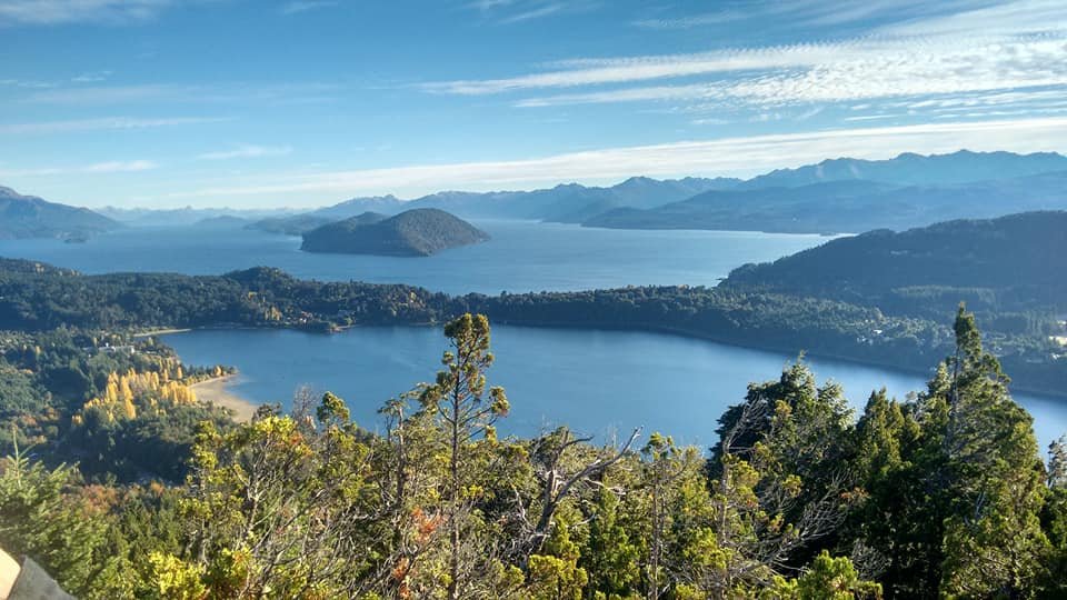
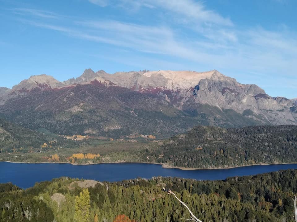
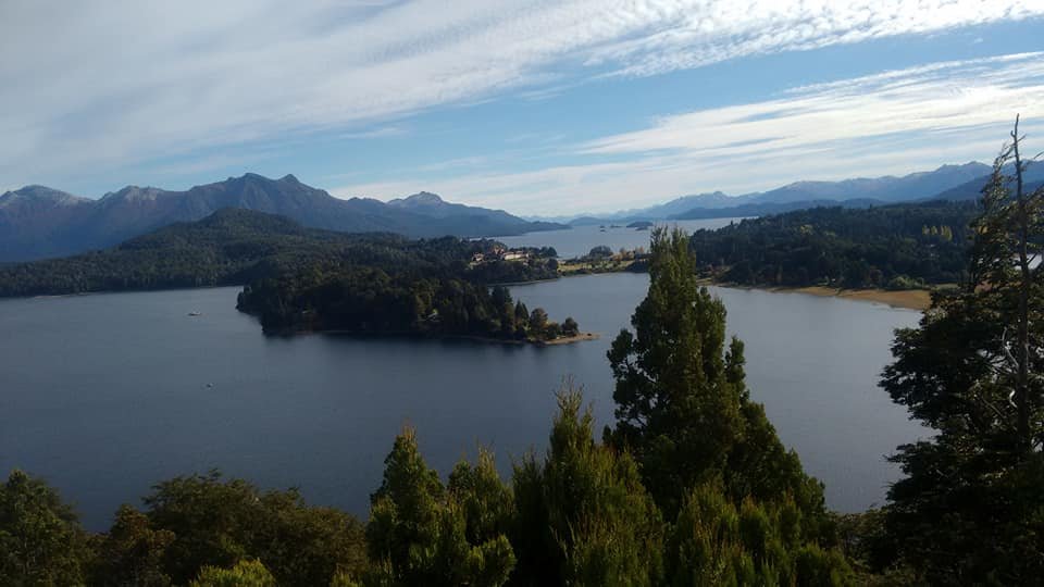
On this journey I saw the most beautiful landscapes I have ever seen. I just couldn't believe that those places were real and right before my eyes.

Lake Espejo neuquen 4.jpg neuquen 5.jpg neuquen 6.jpg

San Martin de los Andes.

San Martín de los Andes is a city that is located on the shores of Lake Nacar. It is a very quiet place, or so it seemed to us when we went. 

Everything was beautiful, but we were surprised by the respect for pedestrians they have. 

We actually put one foot on the street and the vehicles would stop and let you cross. Something never seen before in Buenos Aires .

neuquen 7.jpg neuquen 8.jpg neuquen 9.jpg

La Islita, a small island with a unique history. 

Then we went to "La Islita". It was literally a little island. I have a very funny anecdote. 

Not wanting to ask anyone how to get there, we looked for the way on Google Maps and it threw us a route that said it lasted two hours on foot. 

As we were in good physical condition, we said "okay, two hours walking will not be a problem for us." 

So we set off and actually walked two hours there. We had a lot of fun on the way because we went through forests and laughed at the experience. 

When we finally got to "La Islita", we saw that there was a shorter way to get to the center of the city and it literally took 15 minutes to get back because it was much more direct. 

It was obviously a shortcut that didn't appear on the map. 

We couldn't believe it. Anyway, we had the anecdote to tell our friends . 

neuquen 10.jpg

A beautiful place also in autumn. 

This place was really beautiful. 

As we went in Autumn there was no snow, but I would like to return to see what the city is like when it is covered in white.

neuquen 12.jpg

Source


I visited the city of Bariloche in Rio Negro on two occasions. First, I am going to talk about my last visit, which was last year. 

We went to vacation, in the month of April. The city of Bariloche is a classic winter tourist destination. 

If they ask anyone which city they have to go to see snow, they will surely mention Bariloche. 

In it, is the "Cerro Catedral", which, in addition to being a mountain, houses the most important ski center in South America.

My travel goals 6 of 23: Rio Negro. 

However, by the time we took this trip it was just beginning of fall, so there was absolutely no snow. 

But we were able to enjoy the greenest and most beautiful landscapes of all. 

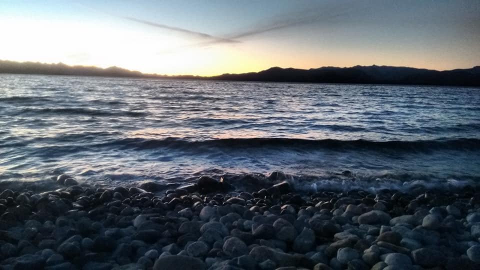
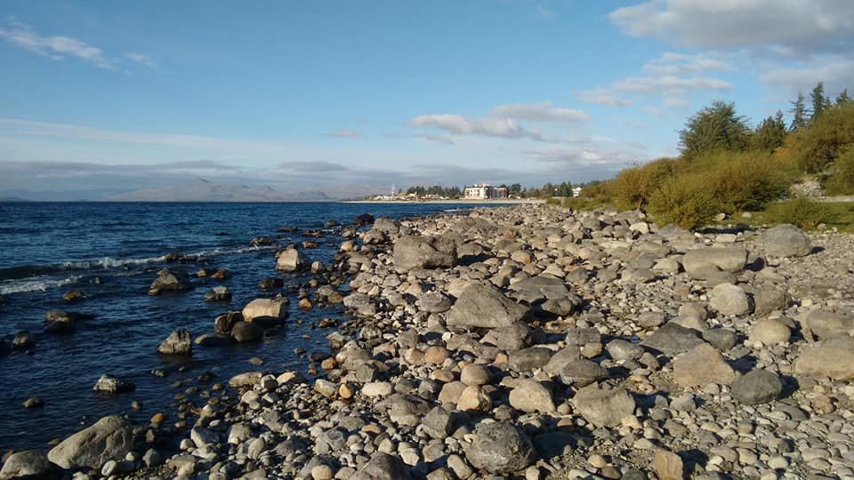
The city itself is beautiful, has many businesses and is very busy. Nearby is Lake Nahuel Huapi, with its icy waters and stone beaches. 

The city of Bariloche is a classic winter tourist destination.

We also went to Cerro Catedral, but of course there was no skiing.

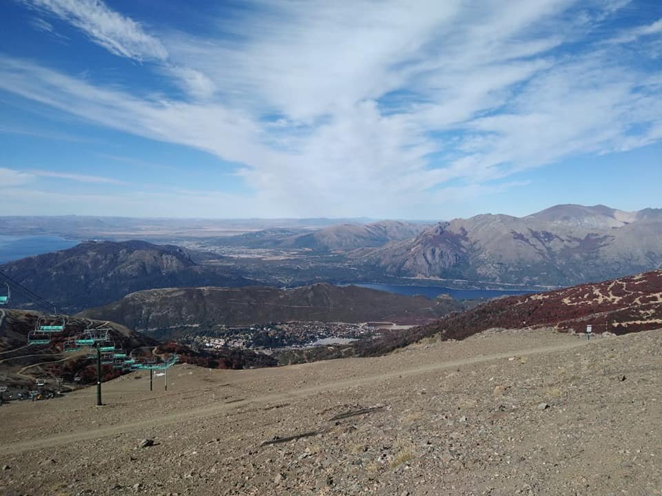
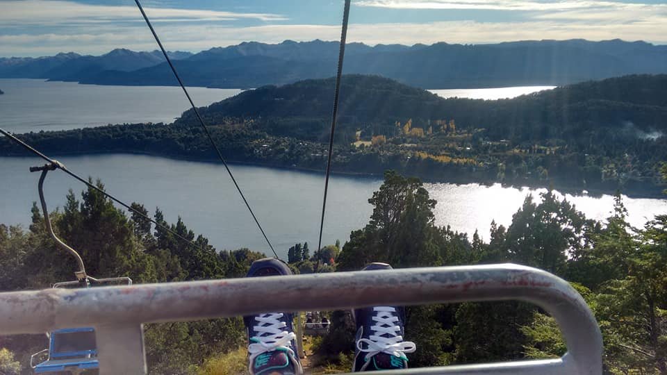
We also visit Cerro Campanario, where you access using a chairlift. From the top of the hill you can enjoy truly incredible views and there is also a cafeteria there in case you want to enjoy a snack.

San Carlos de Bariloche, Cerro Catedral

Lago Nahuel Huapi

59698274_10214595918674778_7170410405607505920_n.jpg

58961666_10214595914394671_666310475998298112_n.jpg

La mia gita di laurea (a long time ago).

Regarding my other visit to Bariloche, it is nothing less than the trip that I mentioned in my first post.

 It was the first time I made a trip away from home and it was for the school graduates trip, in August 2011. 

I was 17 years old, I was very young. On that occasion, most of my colleagues and I met snow for the first time. It was great.

And of course, on last year's trip I had to go to the door of the hotel where I had stayed on my graduate trip to send a photo to my friends with whom I had gone. 

We promised to repeat the ride one day.


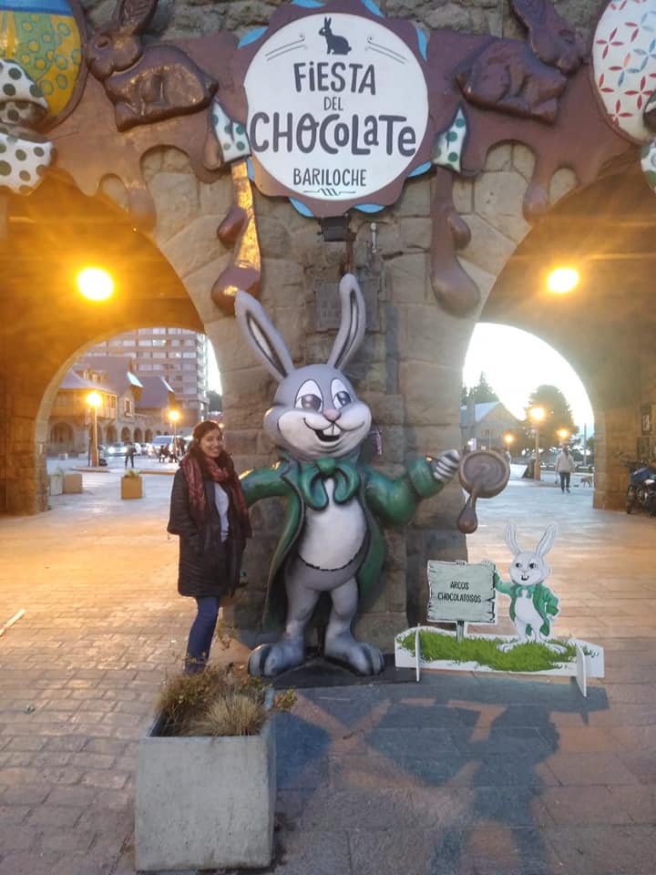
San Carlos de Bariloche, Fiesta el Chocolate

59350700_10214595899794306_3397345914552057856_n.jpg 59515229_10214595942755380_6277069714984271872_n.jpg 59183129_10214595922754880_2493788102322028544_n.jpg 59685320_10214595914234667_5308716144931110912_n.jpg

Source.

22.AbradelAcay9.png


  • Those who are following my stories of Route 40 that I traveled by motorcycle in 2015 can access each of the stages through the references with links and images that they find at the end of this post.
  • But starting today, when we are averaging the middle of the journey, I have decided to intersperse between each stage some stories and impressions of sites and places that I have taken the opportunity to visit.
  • I have seen them as I pass by, I have crossed the signs indicating their location and, sometimes, I have had the time at my disposal to take a brief tour and learn a little more about them.
  • Today I am going to talk to you about the highest road pass in the world outside Asia, the Abra del Acay, located in the jurisdiction of the province of Santa (Argentina).
  • Route 40, also called Libertador General San Martín, is a legendary place to travel by car, motorcycle or hitchhiking.
  • It occupies a privileged place among the most famous roads in the world, due to its length (it has more than 5,000 km), its landscapes and the regions it crosses.
  • As a reference for those who lenn, I found this highway pass, in the second stage of my journey titled [The great journey of Route 40 in Argentina from north to south: the second stage, reaching Abra del Acay.] (Https: // hive. blog / ocd / @ patagonian-nomad / the-great-journey-of-route-40-in-argentina-from-north-to-south-the-second-stage-reaching-abra-del-acay).
  • And today I show you some photos that for reasons of time and space I did not show you at that time.

Abra del Acay.

22.AbradelAcay.png

The Abra del Acay mountain pass remains closed for most of the year due to weather conditions.
22.AbradelAcay1.png

Beautiful sunny day without clouds.
22.AbradelAcay2.png

Andean guanaco typical of the region.
22.AbradelAcay3.png

 Closely guarded by his female harem.
22.AbradelAcay4.png

The more hidden behind some bushes a llama observes them.
22.AbradelAcay6.png

Panoramic view of the Abra del Acay pass.
22.AbradelAcay7.png

Gravel, hollows and inaccessible roads for most of the year.
22.AbradelAcay8.png

 At 4,800 meters of altitude, the first patches of snow begin to be seen.
22.AbradelAcay10.png

The Andean fox discovered by Darwin and named after him.
22.AbradelAcay11.png

The junction with the route that takes us to San Antonio de los Cobres.
22.AbradelAcay12.png

The summit in the Abra del Acay at 4,968 meters above sea level.
22.AbradelAcay13.png
banner.copyright.imagenesScroll_Old_Decorative_Paper_PNG_Clipart_Image.png
 
Copyright © 2015 Argentina Photo Gallery
Distributed By Gooyaabi Templates
-->