F
Showing posts with label Chubut. Show all posts

With this type of travel, where you plan to stay a little longer than usual, it is possible to get to know places that would otherwise have gone unnoticed. Each new city I visit has its own charm, and I like to have enough time to visit as much as I can. During my stay in Esquel I had a lot of free time in the evenings, as I got a very good volunteer shift during the late evening hours. Taking advantage of this scheme, I walked around most of the city, visiting the most touristic places and those that are not so touristic .


$1


One of the most popular areas for tourists is the La Zeta Lagoon. This lagoon can be reached by vehicle, making it a good option for family outings and for getting to be in a beautiful place without making so much physical effort. Of course I love walking to places, so that's how a group of hostel guests and I got there. Autumn was approaching, so we wanted to make the most of the last days of good weather .

IMG_20240312_165527351~2.jpg IMG_20240312_173053875~2.jpg IMG_20240312_165908991.jpg


After staying in the lagoon for a while until the sun started to go down, we decided to walk a little further. The thing about southern Argentina is that in the afternoon the weather can be as hot as summer, but as soon as night falls, the temperature drops abruptly. To warm up a bit we chose one of the many trails around the lagoon, and one of them was the one that took you to the Plaza de los Mates .

IMG_20240312_165941773~2.jpg IMG_20240312_173103300~2.jpg IMG_20240312_170056256~2.jpg IMG_20240312_172801981.jpg


Of all the trails in this area, the one in this square is the shortest and takes only about 20 minutes. A short walk around the lagoon leads to a path that enters the forest and then comes out into a clearing with short grass, where there are some games for children and also a place to spread out. As for the name, it is called ‘de los Mates’ (of the gourds) because it has some gourds carved in wood distributed around the place. In case you don't know, a ‘mate’ is the drink made of yerba mate and hot water that we consume in Argentina, and the recipient in which this infusion is contained has the same name .

IMG_20240312_170553987~2.jpg IMG_20240312_171828233~2.jpg IMG_20240312_170845019~2.jpg


While I like quiet days with little walking and a relaxed atmosphere, from there I was already spotting the mountain I wanted to climb at some point during my stay. The highest mountain in Esquel is called Nahuel Pan, at over 2260 masl, and it was the one we could see from there. That big mountain looked like a physical challenge, and at that moment I felt emboldened to do it. I had done some research on how to climb it and I knew it wouldn't be an easy task, but it was my goal to reach the summit before I left (spoiler: a month and a half later that day, I made it to the top) ❤️.

IMG_20240312_171201850.jpg IMG_20240312_173615303~2.jpg


I liked Esquel so much that little by little the nostalgia of having left El Bolsón faded away and the excitement of getting to know more about a new city began to emerge in me. This nomadic trip took me to a lot of unthinkable places, but I liked it because I know that improvisation can also work. Before being in this corner of Chubut I didn't know much about it, but at that moment, seeing with my own eyes all the beautiful things it had to see and do, I knew it was a good decision to schedule a long stay there. And that was just the beginning ❤️.

source

When I arrived in the city of Esquel I had nothing exactly planned, but I knew that the options for walks would not be long in coming. In my opinion, it always ends up being best to ask the locals for recommendations, because they know more than any internet forum. Luckily, the owners of the hostel where I worked this autumn were very knowledgeable about the city, so they recommended a visit to La Zeta Lagoon as my first trip. I had the option of taking a taxi, but as it was close by, I thought it would be more fun to walk there .


Worldmappin (14).png


From where the flat where I lived with my roommates was located, it was about 6 km to the lagoon. This distance may sound like a lot, but it is fun if you go with someone else. That day I was able to organise with guests from the hostel to go together to the lagoon, so the journey to the lagoon was not so tiring. The path was very easy, all on the vehicle path, so it was impossible to get lost .


IMG_20240312_125630560~2.jpg IMG_20240312_125609511~2.jpg IMG_20240312_125625079~2.jpg


The La Zeta Lagoon area is a nature reserve with a few trails around it. Unless there is usually a special event, we were told that this area is always quiet and that was the case when we were there. The day we were there was beautiful: the weather was inviting to be outside so we spread out our day to do everything we wanted to do. This included a little rest on the shores of the lagoon, but also stretching our legs a bit more to complete some of the trails in the area .

IMG_20240312_132012172~2.jpg IMG_20240312_132435525~2.jpg IMG_20240312_132641647~2.jpg IMG_20240312_132053297~2.jpg IMG_20240312_132041592~2.jpg


The shore of the lagoon seemed to me a good place to rest and spend the afternoon. These waters did not look very deep, but it is said that some people still go there to cool off in the summer. You might think that in the south of Argentina it is always cold, but in places like Esquel, the summers are very hot and the winters are snowy. This autumn we had an in-between climate, with just the right temperature to be outside enjoying the day without suffering from either extreme .

IMG_20240312_131443104~2.jpg IMG_20240312_132346973~2.jpg IMG_20240312_132308860~2.jpg IMG_20240312_133551124~2.jpg


The postcard of Esquel from the Laguna La Zeta is one of the most beautiful you can have of this place. I recommend visiting this place around sunset, when the sun starts to go down and form a mirror on the water. The combination of mountains and lagoon with some green around is beautiful, creating a unique landscape all day long. I quite enjoyed visiting this place, it was so peaceful and quiet that it didn't even seem to be that close to the city .

IMG_20240312_174732071~2.jpg IMG_20240312_174845354~2.jpg IMG_20240312_173605708~2.jpg


Of course, if we had taken a taxi the journey would only have taken about 20 minutes, but I think walking also had its magic. The part I like the most about volunteering in different hostels in my country is the social part, like that day when we had the opportunity to share an extra moment with the guests. Visiting Laguna La Zeta for the first time was great, and I liked it so much that I took the trouble to go a few more times to spend my free afternoons. A place as beautiful and peaceful as this deserves to be visited several times, and that's exactly what I did ❤️.


IMG_20240312_175122106~4.jpg

source

Cerro Pirque in Chubut, Patagonia, has been burning for several days due to summer forest fires, destroying one of the last virgin Andean-Patagonian forests and threatening endangered species like the huemul deer. Experts warn the damage could be irreversible, with biodiversity loss and ecosystem collapse highly likely.

Key Facts About the Fire

  • Location: Cerro Pirque, near Puerto Patriada and Lago Epuyén, Chubut, Argentina.

  • Duration: The fire has been active for at least four consecutive days.

  • Cause: Authorities suspect intentional ignition, worsened by drought, high temperatures, and strong winds.

  • Scale: More than 60 hectares have already been affected in past incidents, and current damage is spreading rapidly.

  • History: Cerro Pirque has suffered four major fires since 1987, showing a recurring vulnerability.

Biodiversity at Risk

  • Huemul deer (Hippocamelus bisulcus): Critically endangered, with Cerro Pirque serving as a rare refuge.

  • Virgin Andean-Patagonian forests: These ecosystems are unique, hosting native species of flora and fauna found nowhere else.

  • Irreversible damage: Specialists warn that the loss of primary forest cover could permanently alter the ecological balance.

Environmental Impact

  • Habitat destruction: Loss of nesting and feeding grounds for birds, mammals, and insects.

  • Soil degradation: Fires strip protective vegetation, increasing erosion and reducing regeneration capacity.

  • Carbon emissions: Large-scale release of stored carbon worsens climate change.

  • Water systems: The fire threatens watersheds feeding Lago Epuyén, impacting local communities and tourism.

Challenges in Containment

  • Topography: Steep slopes make firefighting difficult.

  • Weather: Strong winds accelerate fire spread.

  • Resources: Local brigades face limited equipment and manpower.

  • Negligence: Past fires have been linked to poor handling of ashes and human activity.

Broader Context

  • Climate change: Rising temperatures and prolonged droughts increase fire frequency and intensity.

  • Human factor: Intentional or negligent ignition remains a major driver of forest fires in Patagonia.

  • Conservation urgency: Protecting Cerro Pirque is critical for maintaining biodiversity corridors in the southern Andes.

Takeaway

The summer forest fires on Cerro Pirque represent an ecological tragedy, threatening endangered species and unique ecosystems. Immediate containment is essential, but experts caution that long-term recovery may be impossible if virgin forests are lost. Strengthening fire prevention, monitoring, and conservation policies in Patagonia is now more urgent than ever.

The National Park Lago Puelo is one of the most beautiful and unique reserves of PatagoniaThe Lago Puelo National Park  is a national park of Argentina, located in the northwest of the province of Chubut, in the Patagonia.

It has an area of 276.74 km². It was created in order to protect its wonderful landscape and the Valdivian flora, as an annex to the Los Alerces National Park, and declared National Park and independent reserve in 1971.


The National Lago Puelo.

The protected area is named after the Puelo Lake, and belongs to the Patagonic forest and steppes and High Andes eco-regions, with maximum heights of two hundred meters over sea level.

The mountainous zone where the park lies was modified by the action of glaciers, which created many rivers and lakes, including the one (Puelo Lake) that gives the park its name. The rivers of the region show high levels of glacier sediment (silt), which gives Puelo Lake its blue color.

The National Park Lago Puelo is one of the most beautiful and unique reserves of Patagonia.Click To Tweet

Climate.

The climate is cold and wet, although more temperate than other parks in the region.Mean temperatures range from 5 °C (41.0 °F) in winter to 17 °C (62.6 °F) in summer. Mean annual precipitation is around 1,400 mm (55 in), most of it being concentrated between May to August. Occasionally, snowfall can occur during the coldest months.

Flora and Fauna.

Some of the flora of the park belongs to the Valdivian rain forests (avellano, tique, lingue, ulmo). It also includes the ciprés de la cordillera, the coihue, the lenga, the radal, and the arrayán. The rosa mosqueta is an exotic plant.

The fauna includes the pudú, the huemul, the red fox, the cougar, and the coipo. Among birds we find the huala, the pato vapor volador, the bandurria, the pitío and the zorzal patagónico.


The lake features native fish such as the perca, the peladilla and the puyén grande, and foreign species of trout.

History.

If you liked this article, subscribe to the feed by clicking the image below to keep informed about new contents of the blog:
rss-icon-feed1
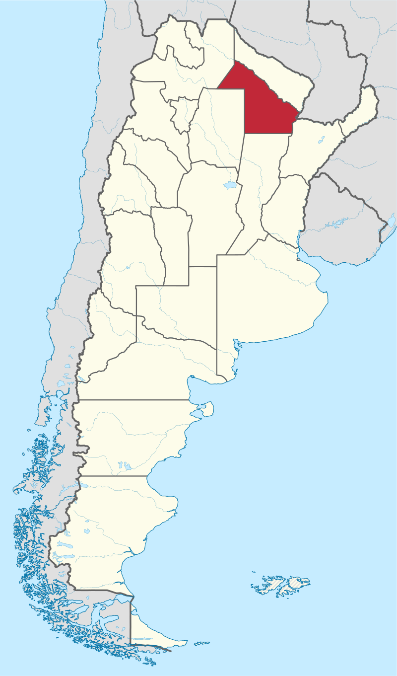
In Argentina it is called province to the states that make up the nation, according to the principles of federalism established in the Constitution. Legally Argentina is a federation of provinces and maintained by constitutional mandate the historical names of United River Plate and Argentina Confederation Provinces, in addition to the more usual Argentina.
 
Argentine provinces govern themselves, they write their own constitutions and have executive, legislative and judicial powers themselves, including their own provincial police. Fourteen of them are historically and legally existed prior to the current national organization, and with nine subsequently created exclusively retain all powers not expressly delegated to the Nation in the Constitution.
Official name:
Argentinian republic
Total area:
3,761,274 km2
Sup. Americas
2,791,810 km2
Sup. Antarctic Continent
969,464 km2
Capital:
Autonomous City of Buenos Aires
Political division:
1 autonomous city and 23 provinces
Government:
Republican Representative and Federal
Population:
40,117,096 inhabitants. 2010 Census.
Language:
Spanish
Monetary unit:
Weight
Autonomous City of Buenos Aires.
Capital
Capital City of Argentina
Surface:
200 km2
Population:
2890151 hab.
Argentine provinces.
BUENOS AIRES.
Capital city
La Plata
Surface:
307,571 km2
Population:
15625084 hab.
CATAMARCA.
Capital city
San Fernando del Valle de Catamarca
Surface:
102,602 km2
Population:
367,828 hab.
CHACO.
Capital city
Resistance
Surface:
99,633 km2
Population:
1055259 hab.
CHUBUT.
Capital city
Rawson
Surface:
224,686 km2
Population:
509,108 hab.
Read also: Argentina is composed of nine geographical regions.
CORDOVA
Capital city
Cordova
Surface:
165,321 km2
Population:
3308876 hab.
CURRENTS.
Capital city
currents
Surface:
88,199 km2
Population:
992,595 hab.
BETWEEN RIVERS.
Capital city
Paraná
Surface:
78,781 km2
Population:
1235994 hab.
FORMOSA.
Capital city
Formosa
Surface:
72,066 km2
Population:
530,162 hab.
JUJUY.
Capital city
San Salvador de Jujuy
Surface:
53,219 km2
Population:
673,307 hab.
THE PAMPA.
Capital city
Saint Rose
Surface:
143.440 km2
Population:
318,951 hab.
THE RIOJA.
Capital city
The Rioja
Surface:
89,680 km2
Population:
333,642 hab.
MENDOZA.
Capital city
Mendoza
Surface:
148,827 km2
Population:
1738929 hab.
MISSIONS.
Capital city
posadas
Surface:
29,801 km2
Population:
788,915 hab.
NEUQUÉN.
Capital city
Neuquén
Surface:
94,078 km2
Population:
388,833 hab.
BLACK RIVER.
Capital city
Viedma
Surface:
203,013 km2
Population:
638,645 hab.
SALTA.
Capital city
Salta
Surface:
155,488 km2
Population:
1214441 hab.
SAN JUAN.
Capital city
San Juan
Surface:
89.651 km2
Population:
681,055 hab.
SAINT LOUIS.
Capital city
saint Louis
Surface:
76,748 km2
Population:
432,310 hab.
SANTA CRUZ.
Capital city
Rio Gallegos
Surface:
243,943 km2
Population:
273,964 hab.
SANTA FE.
Capital city
Santa Fe
Surface:
133,007 km2
Population:
3194537 hab.
SANTIAGO DEL ESTERO.
Capital city
Santiago del Estero
Surface:
136,351 km2
Population:
874,006 hab.
TUCUMÁN.
Capital city
San Miguel de Tucuman
Surface:
22,524 km2
Population:
1448200 hab.
TIERRA DEL FUEGO, Antarctica and South Atlantic Islands
Capital city
Ushuaia
Total area:
1,002,445 km2
Sup. Antartida
965,597 km2
Sup. Austral Islands
3867 km2
Population:
127,205 hab.
Bibliography:
  • IGN: Values ​​calculated on surface mapping at 1: 500,000
  • INDEC: Facts Conclusive population Census Population and Housing 2010.
  • Immagini: Wikipedia
If you liked this article, subscribe to the feed by clicking the image below to keep informed about new contents of the blog:
rss-icon-feed1
 
Copyright © 2015 Argentina Photo Gallery
Distributed By Gooyaabi Templates
-->