F
Showing posts with label La Rioja. Show all posts
For the original peoples, rock art was a tool for communication, a way to transfer ideas, experiences and convictions, a way to reaffirm their own and to participate in other groups of that message put in the immensity of the landscape with the intention aware, that they will last in physical space and time.

In turn, it was a way of intervening territorially, especially when we understand the nomadic condition of its producers, making reference to its inter-related actions related to space: in territorial exploration, in the search for material resources and in ritualization in The geographical spaces.

Therefore, the human figure in rock art cannot be interpreted as an illustrative representation, it is much more than that. The worldview of the South American native peoples includes animated beings and inanimate elements, all of them forming part of an integrated whole that carries the character of sacred.

The human being was understood within that whole.

The representation of human figures in the rock art of the Cuyo region.


The human being was understood within that whole. That sacredness was rooted in the naturalistic and mystical thinking of the people that also hierarchized and deeply respected the characters of power within the community.

This hierarchy is evident in all rock art. Thus, certain human figures have the schematic simplicity and smaller sizes compared to those that show the attributes of power, differing both in the set.
Read also: The lonely Pucará de Hualco, a city of stone, more than a thousand years old.
But whatever its appearance, the human figure, in rock art, is always based on an idea conceived by the naturalistic thinking of the original peoples who considered those of their kind a part in nature and not the axis of the system; which is the most widespread conception in our western and contemporary thinking.

Cuyana region.


In Mendoza, they are chronologically attributed to the period between 400 and 600 years and are culturally associated with the Ovalle style of the Valley of Enchantment in Chile and the culture of El Molle (300 BC-700 AD). This, at later times, would be associated with the Aguada income and would result from an incorporation given by farming groups in the area, which allows us to propose a temporary projection until 900.


The rock manifestations have received different interpretations, predominantly those that emphasize the role associated with shamanic practices. In Mendoza, within the anthropic manifestations, those that refer to heads and mascariforms stand out, which by stylistic association allowed them to be linked culturally and chronologically, but that at the interpretative level led to postulate the representation of experiential experiences of ceremonies where the human head stood out as the center of power and possessor of special forces.

These images would be enhanced as a result of experiences derived from the use of hallucinogenic substances, which, by altering the senses, would favor images in a trance state.
Human figure: hierarchical attributes.

Representation of the human figure.


The human figure is more frequent in the north of the region. In almost all cases they are recorded although we also see it painted, as in the peach eaves in San Rafael.

The representation of some parts of the body is very frequent. In Malargüe the body appears but without head or heads without the body and also the imprint of the human foot.

Other figures move away from a realism and become a different scheme in which the human figure is transformed into a symbolic element, for example the drawing of the head with upper and lower limbs - without the torso - with appendages that start from the same in radial form or with ornamentations in the superior part, as it is the case of the paintings of Los Morrillos and in the Colorados of San Juan and Tundunqueral, in the north of Mendoza.

With variants, the head alone is presented with cephalic attributes or the head with ornamentations and the lower limbs (Tundunqueral, Mendoza and Los Colorados, San Juan). These designs were linked to the tiaras or mascariform heads of the Northern Chilean Boy.

Frequently the characters in rock art are accompanied by birds, felines, snakes and other animals that occupy primary places in the graphic set makes us think that they played an important role in their lives and were part of their rituals. The characters are also seen carrying camelids on a rope, or their stumps or pregnant females, which shows their status as hunter gatherers and the preponderance of these animals in obtaining resources.

The rock, in many cases, is part of the composition and the landscape participates as the setting for the unifying mother earth of "everything." This can be seen in some creations in which engraving and support make up the design, as is the case of the mascariform figure of Painted Stones in San Juan in which the oval shape of rock constitutes the contour of the mascariform.

On a slope of the Sierra de Velasco, north of the province, there is a stone city, more than a thousand years old. Its walls treasure the memory of the Hualco culture. Tourists, scientists and archaeologists travel today.

The excursion to the ruins of Hualco begins directly on route 40, which serves as the main street of the handful of small towns scattered along the route and the Los Sauces river. This crystal clear river is used by farmers to plant the surrounding land with fruit and vegetables.

During the trip, the local guide Fabián Yapura takes tourists to see the different villages in the area, their picturesque churches and their adobe houses in complete harmony with nature.

In Alpasinche, one of those small towns, your old vineyards attract attention, whose fruits are ground in the family wineries where the Patero wine is made.

When you reach the town of San Blas you can see the homonymous church -data from 1732-, where every February 3 the patron saint of the gorges is worshiped in a religious festival that is a true festival of song.

Less than a kilometer the route forks and you have to leave the national route 40 to take the left and go into the mountainous landscape and the Hualco streams.

The wild road that leads to the ravines, contrasts with the dense vegetation that is seen in the valley that sleeps at your feet. The greenery gave the name to the area known as Valle Fertil or Valle Vicioso.
Trio of gorges. Further ahead is the El Rincón stream, the first of a triad that includes Hualco, where the archaeological site is located, and Andolucas.

The Andolucas stream is famous for the deep backwaters that form with the fresh waters that come down from the mountain and fall with force in the form of a jet in a great natural piletón called the Olla de Andolucas.

It also has camping and infrastructure to stay several days, like El Rincon. Three other streams complete the natural mosaic, but the access to its water pools are exclusive for adventurers who dare to climb giant rocks surrounded by flowering cacti. The postcard is worth it.

Interpretation Center. The Interpretation Center was inaugurated on January 30. It is built with materials from the area such as adobe, wood and cane.
It is the starting point where the circuit begins towards the ruins themselves.

In this place many of the objects found during the excavations are exhibited: vessels, earthen pots, arrowheads, ornaments and even a funerary urn approximately 50 centimeters in diameter with bones inside.

In addition there are gigantografías that explain from the discovery of the place in the decade of 1950 by the priest Martín Gómez until the last works of restoration.

In Argentina it is called province to the states that make up the nation, according to the principles of federalism established in the Constitution. Legally Argentina is a federation of provinces and maintained by constitutional mandate the historical names of United River Plate and Argentina Confederation Provinces, in addition to the more usual Argentina.
 
Argentine provinces govern themselves, they write their own constitutions and have executive, legislative and judicial powers themselves, including their own provincial police. Fourteen of them are historically and legally existed prior to the current national organization, and with nine subsequently created exclusively retain all powers not expressly delegated to the Nation in the Constitution.
Official name:
Argentinian republic
Total area:
3,761,274 km2
Sup. Americas
2,791,810 km2
Sup. Antarctic Continent
969,464 km2
Capital:
Autonomous City of Buenos Aires
Political division:
1 autonomous city and 23 provinces
Government:
Republican Representative and Federal
Population:
40,117,096 inhabitants. 2010 Census.
Language:
Spanish
Monetary unit:
Weight
Autonomous City of Buenos Aires.
Capital
Capital City of Argentina
Surface:
200 km2
Population:
2890151 hab.
Argentine provinces.
BUENOS AIRES.
Capital city
La Plata
Surface:
307,571 km2
Population:
15625084 hab.
CATAMARCA.
Capital city
San Fernando del Valle de Catamarca
Surface:
102,602 km2
Population:
367,828 hab.
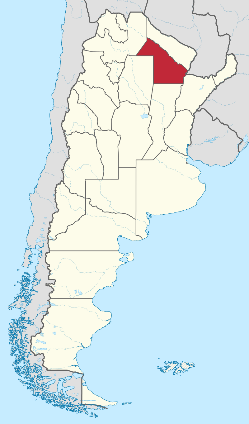
CHACO.
Capital city
Resistance
Surface:
99,633 km2
Population:
1055259 hab.
CHUBUT.
Capital city
Rawson
Surface:
224,686 km2
Population:
509,108 hab.
Read also: Argentina is composed of nine geographical regions.
CORDOVA
Capital city
Cordova
Surface:
165,321 km2
Population:
3308876 hab.
CURRENTS.
Capital city
currents
Surface:
88,199 km2
Population:
992,595 hab.
BETWEEN RIVERS.
Capital city
Paraná
Surface:
78,781 km2
Population:
1235994 hab.
FORMOSA.
Capital city
Formosa
Surface:
72,066 km2
Population:
530,162 hab.
JUJUY.
Capital city
San Salvador de Jujuy
Surface:
53,219 km2
Population:
673,307 hab.
THE PAMPA.
Capital city
Saint Rose
Surface:
143.440 km2
Population:
318,951 hab.
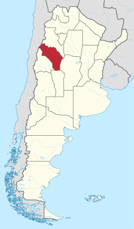
THE RIOJA.
Capital city
The Rioja
Surface:
89,680 km2
Population:
333,642 hab.
MENDOZA.
Capital city
Mendoza
Surface:
148,827 km2
Population:
1738929 hab.
MISSIONS.
Capital city
posadas
Surface:
29,801 km2
Population:
788,915 hab.
NEUQUÉN.
Capital city
Neuquén
Surface:
94,078 km2
Population:
388,833 hab.
BLACK RIVER.
Capital city
Viedma
Surface:
203,013 km2
Population:
638,645 hab.
SALTA.
Capital city
Salta
Surface:
155,488 km2
Population:
1214441 hab.
SAN JUAN.
Capital city
San Juan
Surface:
89.651 km2
Population:
681,055 hab.
SAINT LOUIS.
Capital city
saint Louis
Surface:
76,748 km2
Population:
432,310 hab.
SANTA CRUZ.
Capital city
Rio Gallegos
Surface:
243,943 km2
Population:
273,964 hab.
SANTA FE.
Capital city
Santa Fe
Surface:
133,007 km2
Population:
3194537 hab.
SANTIAGO DEL ESTERO.
Capital city
Santiago del Estero
Surface:
136,351 km2
Population:
874,006 hab.
TUCUMÁN.
Capital city
San Miguel de Tucuman
Surface:
22,524 km2
Population:
1448200 hab.
TIERRA DEL FUEGO, Antarctica and South Atlantic Islands
Capital city
Ushuaia
Total area:
1,002,445 km2
Sup. Antartida
965,597 km2
Sup. Austral Islands
3867 km2
Population:
127,205 hab.
Bibliography:
  • IGN: Values ​​calculated on surface mapping at 1: 500,000
  • INDEC: Facts Conclusive population Census Population and Housing 2010.
  • Immagini: Wikipedia
If you liked this article, subscribe to the feed by clicking the image below to keep informed about new contents of the blog:
rss-icon-feed1
1.- A traditional tour of the city of Buenos Aires and Caminito Street Museum Quinquela Martin.
A traditional tour of the city of Buenos Aires and Caminito Street Museum Quinquela Martin.
The October 18, 1959 with the presence of Buenos Aires mayor Hernán Giralt, and other senior officials was officially opened Caminito Street, between the sound of the bombs and the wailing sirens of the boats. The noise of the Boca family was complete and the musician ovation. Since then the Caminito of La Boca became a meeting place for Argentines and foreigners included in the tourist guide

2.- Yabotí Biosphere Reserve, missionary natural heritage.
Yabotí Biosphere Reserve, missionary natural heritage.
The Biosphere Reserve Yabotí ("turtle" in Guarani) is located in the departments of San Pedro and Guaraní, the municipalities of San Pedro and the Magnificent (the center area of the province of Misiones, comprising Flag of Argentina.svg Argentina). There are clearly influenced by the towns of San Pedro, with 18,069 inhabitants, The Proud, with 15,109 hab., And San Vicente, with 27,693
3.- Recovery Center and Breeding Bird Endangered Guira Oga, in the heart of the missionary forest.
Recovery Center and Breeding Bird Endangered Guira Oga, in the heart of the missionary forest.
Guira Oga was built in the jungle using the spaces opened by the fall of large trees by the wind, storms and heavy rains, meaning that the construction was not removing a single tree, demonstrating that the man, when He proposes, can live in harmony and balance without modifying or destroying the ecosystem in which it occurs. In 1994, the Ornithological Association of the Silver (Aves
4.- The "Cañadón de Profundidad" Provincial Park and the captivating atmosphere of the jungles of Urunday.
The
The "Cañadón de Profundidad", located about 30 kilometers from the capital of the province of Misiones, the city of Posadas, Provincial Park was created in order to have an area for education and recreation, in the vicinity of the former city, and therefore only represents a small sample of beautiful and captivating environment Urunday jungles, although it has a total area of 19 hectares.
5.- The Yacuy Provincial Park is a protected natural area in the province of Misiones.
The Yacuy Provincial Park is a protected natural area in the province of Misiones.
The Yacuy Provincial Park is a protected area of the province of Misiones Argentina natural area. It is located in the General Manuel Belgrano Department and has an area of 347 hectares. It is an annex of the Iguazu National Park and its purpose is to protect the ecosystem of the river basin Yacuy. It was created in 1991 by Act No. 2876. Location: General Manuel Belgrano department,
6.- The 10 Most Popular Posts on Argentina Photo Gallery in July 2015.
The 10 Most Popular Posts on Argentina Photo Gallery in July 2015.
1.- The Chaco National Park is a national park of Argentina, located in the province of Chaco. The Chaco National Park is a national park of Argentina, located in the province of Chaco. It has an area of 150 km². It was created in 1954 in order to protect a sample of the Eastern Chaco, composed mainly of warm lowlands, with an annual summer rainfall between 750 and 1,300 mm. This park is a
7.- Science and technology in Argentina.
Science and technology in Argentina.
The history of science in Argentina describes the fate of researchers and scientific institutions of the country, often exposed to the elements of its economy and its politics, but able, nevertheless, to produce enduring works and useful to know and technology. The times of the governments of Bernardino Rivadavia and Domingo Faustino Sarmiento , or the generation of 1880 , or the luminous years
8.- The Chaco National Park is a national park of Argentina, located in the province of Chaco.
The Chaco National Park is a national park of Argentina, located in the province of Chaco.
The Chaco National Park is a national park of Argentina, located in the province of Chaco. It has an area of 150 km². It was created in 1954 in order to protect a sample of the Eastern Chaco, composed mainly of warm lowlands, with an annual summer rainfall between 750 and 1,300 mm. This park is a protected area for the quebracho trees. Forests of quebracho colorado chaqueño (Schinopsis
9.- Summer holiday destination for millions of Argentines, the Atlantic coast has some excellent beach resorts.
Summer holiday destination for millions of Argentines, the Atlantic coast has some excellent beach resorts.
Summer holiday destination for millions of Argentines, the Atlantic coast has some excellent beach resorts, while inland in the sierra there is fine countryside to explore. Atlantic coastline. Like most people, Argentines like to see the sea and will endure congested roads and standing-room-only beaches to do so. No sooner is the New Year’s celebration over than large swathes of the Buenos
10.- Jaramillo Petrified Forest.
Jaramillo Petrified Forest.
The logs and pine nuts found correspond to a monkey-puzzle tree species with similar features to those upholstering the mountains of Neuquén and they are the object of constant scientific research. At Puerto Deseado, it is possible to get away from the coast towards the mountain range area and set foot on the most important fossil site in Argentina: Jaramillo Petrified Forest. Several stops can
If you liked this article, subscribe to the feed by clicking the image below to keep informed about new contents of the blog:
rss-icon-feed

We continue with the legendary Route 40 One of the most compelling circuits National Route 40, which runs more than 5,000 miles from Argentina, is passing through the region of Cuyo.

The provinces of Mendoza, San Juan and La Rioja, surprise the traveler with the best Malbec in the country, Talampaya National Park and the Valley of the Moon.

infografia_ruta_40_cuyo

Mendoza and San Juan is a good choice for Adventure lovers and wine. Today I have the main attractions in this circuit:
It offers a lot of wineries that open their doors to tourism. The vines grow in a desert land, transformed by man through irrigation ditches, canals and reservoirs.
andes
 
Copyright © 2015 Argentina Photo Gallery
Distributed By Gooyaabi Templates
-->