F
Showing posts with label Landscapes. Show all posts
Merlo is located in the Department of Junín, within the province of San Luis , is one of the microclimates of the world, the city with the best environmental quality in the country.

In addition to its beautiful landscapes in Merlo you can enjoy the summer in its spas and streams . Here we offer you a practical guide with its locations and characteristics so that you can enjoy the full summer in Villa Merlo .
merlo-san-luis
Streams.
Arroyo El Molino : 4 Km. From the center of Merlo, by Route Nº 5, in Rincon del Este.In the building there is Confectionery-Restaurant. Access to the stream: free. Towards the sierra is the Salto del Tabaquillo, waterfall of 15 meters in height.
arroyo-el-molino
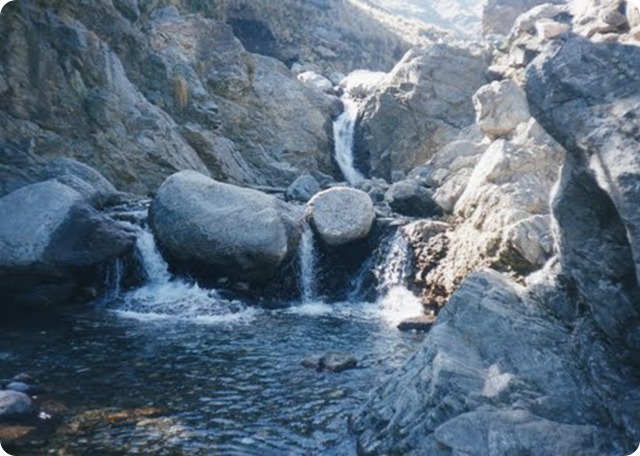
Arroyo Pasos Malos : Climbing along the paved road from Avenida Dos Venados and continue up to the end of the road where the Godoy family property (parking is charged) and from there go down to the stream that has its springs in the Sierras de los Comechingones. You can reach the Forgotten Waterfall by going up the stream with a qualified guide.
arroyo-pasos-malos-san-luis
Arroyo San Miguel : Passing Cortaderas, about 4 km further on, always by Provincial Route No. 1.Entering the street that passes to the side of the Chapel you can enter this arroyo.tiene sandy beaches and the waters are more temperate.
Read also: The 8000-year-old Intihuasi Caves are the oldest in the region.
Spas.
merlo-san-luis-arroyo-san-miguel
Municipal Recreation Center of Villa de Merlo : On Avenida del Ciprés, 7 blocks from Plaza Central, this spa has: large pool and another for children, sports playground, stage, sanitary and confectionery. You can enter the property without charge but the access to the pool is charged.
ParqueRecreativoMerlo
Balneario Municipal El Rincón : On Av. De los Césares 2095. The flow of the Juan Perez Stream, provides water to this pool. Under the shade of the willows, on the banks of the arroyito, there are roasters, tables and sidewalks, behind the confectionery hall There is sanitarios.Se can camp by paying the stay.
Balneario Municipal El Rincón
Balneario Municipal de Carpintería: S e is located 7 Km. From Villa de Merlo, by Provincial Route No. 1 and up by pavement another 3 km. Towards the mountains, there is the spa within the campground that has: barbecue, sanitary. In season is charged entrance.
Balneario Municipal de Carpintería
If you liked this article, subscribe to the feed by clicking the image below to keep informed about new contents of the blog:
rss-icon-feed1
The Los Alerces National Park is located in the west of the province of Chubut.
It has an area of ​​259,570 hectares belonging to the Patagonian Forests ecoregion.
Decree No. 1937 105 433 set for different areas in the Andean Patagonia status reserves bound for the subsequent creation of National Parks.
One of these territories was the Reserve Larches.

los-alerces-map 

The Chaco National Park is a national park of Argentina, located in the province of Chaco.

It has an area of 150 km². It was created in 1954 in order to protect a sample of the Eastern Chaco, composed mainly of warm lowlands, with an annual summer rainfall between 750 and 1,300 mm.

chaco-national-park4

A 1,300 km from Buenos Aires, in the regions of the Northwest, tourism is making its first trial and is almost exclusively powered by Argentines, who wander from the troubled tribal roots and their Andean nation.

Vertically above the Tropic of Capricorn, there are places like Cafayate, with its spectacular quebrada dug by the waters, or Purmamarca, with the Cerro de los Siete Colores that seems a work of pop art, which can happen to meet some coaches portenos, residents of the capital, on vacation.


Argentina offers many unspoiled destinations almost from the tourist point of view. One is the Route of the Volcanoes in Catamarca in northwestern Argentina, a magic circuit for adventure lovers, landscapes and photography.
The route is a winding, uphill road, which passes through 19 volcanoes of over 6000 meters high, countless peaks, lakes of red and turquoise, hot springs, sparse vegetation and exotic animals like flamingos, wild donkeys and guanacos.
catamarca geomap 

1.- Cape Two Bays is considered the most beautiful in the coastal protected areas system.

cabo dos bahiasCape Two Bays is considered the most beautiful in the coastal protected area system by contrasting their brownstones landscape and the blue sea. It has an extraordinary diversity of wildlife is inhabited not only by penguins Magellanic but also seals, guanacos and cormorants, among other wildlife. Some of seabirds that inhabit this place used as the sole breeding site.


2.- Choele Choel is the most important urban center of what is denominated Half Valley.

choele_choel_cartelChoele Choel was founded July 9 1879 by the general Conrado Villegas in the island Pacheco, with the name Nicolás Avellaneda. It was razed little time later by a flood and the soldiers and their families, next to some civilians, they settled in the well-known place as Pampas de losMolinos, where it remained up to March of l882 18, it dates in that was transferred to their current location.


3.- Las Grutas are located in the Gulf San Matías on the Atlantic coast of the Province of Río Negro.

las grutas mapThe coast Atlantic rionegrina has three important and outstanding points, one to be a highly converged tourist center, another to be center of the commercial marine fishing, and the third to constitute a fundamental support for the economic activity of the Patagonia. We are speaking of Las Grutas, San Antonio Oeste and Puerto San Antonio,, respectively. To Las Grutas they arrive every year tourists' thousands willing to have a good time, to relax you and to pass it well. They arrive attracted by their beaches with cliffs of incredible beauty, and for the famous warm waters of these costs.


4.- Discover Jujuy: Community-Based Rural Tourism.

jujuy turismo-rural-22What does it mean for us the Community-Based Rural Tourism and how do we understand it?

The Community-Based Rural Tourism means solidarity tourism activities from an intercultural perspective relating the rural community with visitors, with joint participation of its members, tending to an adequate management of natural resources and cultural heritage assessment, based on principles of equity and fairness, and in the distribution of profits.


5.- Discover Jujuy: Cultural Turismo, A Melting Pot of Cultures.

Carnavalito_en_HumahuacaThe celebration of Carnival in February; or March during Easter Time; or the Pachamama ceremony during August, are some of the many cultural alternatives offered by the Province. In La Puna, a faithful reflection of the High Andean Plateau, you can find traces of people who sealed milestones in Argentina and South America, such as the Inca Trail or manifestations of rock art, petroglyphs and archaeological remains from various origins.


6.-  Discover Jujuy: Religious Tourism, Unique Religious Attractions In The Country.

turismo religioso iglesiaThe Province of Jujuy offers a calendar filled with religious festivities, a product based on the important roots of the catholic faith and spiritual influence on its population. 

7.- Carlos Casalla father of legendary cartoon character Cape Savino.

Father of the legendary cartoon character Cape Savino, settled in Bariloche Casalla fifty years ago. Smart and warm, was the last in his stories in a rigorous manner. The Great Lake, one of his last works, was selected by UNESCO as a reference against discrimination.


8.- Cuesta de Miranda, spectacular mountain road flanked by deep valleys and gorges.

cuesta-de-miranda_jpgLa Cuesta de Miranda is a beautiful, winding stretch in which National Route 40 runs through the pass between the Sierras de Famatina Sañogasta and Chilecito between Villa Union and La Rioja.
Cuesta also known as "the" Miranda, this stretch of Route 40 naughty step, broken (or "costs") that cuts through the Sierra de Famatina (north) and those of Sañogasta (south) following after the deep valley of the river Miranda. Is not entirely asphalt.


9.- Neuquén has strong cultural roots on the millenarian mapuche tradition.

Neuquén (in mapuche language, “daring, and vehement”) has strong cultural roots on the millenarian mapuche tradition (mapu – land, che – people).
Presently many mapuche communities live in Neuquén territory, especially in Patagonia of Lakes, and they give value to their vision of the world and their customs inviting people to visit their lands and share their traditions.


10.- From Uritorco water flows down, many in underground, coming to form springs.

uritorco The Uritorco is a hill of 1949 m in the center of Argentina, located in the north Punilla Valley, close to Capilla del Monte, in the province of Cordoba , accessible routes provincial RN 38 and 17. Its summit is the highest point of the Sierras Chicas, formerly called Viarava. It is considered the sixth Córdoba Natural Wonder.

If you liked this article, subscribe to the feed by clicking the image below to keep informed about new contents of the blog:

cuesta-de-miranda La Cuesta de Miranda is a beautiful, winding stretch in which National Route 40 runs through the pass between the Sierras de Famatina Sañogasta and Chilecito between Villa Union and La Rioja.

Cuesta also known as "the" Miranda, this stretch of Route 40 naughty step, broken (or "costs") that cuts through the Sierra de Famatina (north) and those of Sañogasta (south) following after the deep valley of the river Miranda. Is not entirely asphalt.

The cost is one of the few steps passable in this area and is the only tour of a road, which connects the Valley of Chili, Famatina and even Arauco, with Cuyo.

cuesta-de-miranda_jpg Une Chilecito localities (north) with Villa Union (south).

It is a spectacular tourist attraction, with a landscape stained varying shades of red and vermilion intense in a way that sways between the mountains and the deep canyon of the river, which is seen there, very down.

The road at the climax of the tour is the cornice, with exciting curves and cliffs that continue the physiognomy of Talampaya.

While you can visit all year round, remember that in winter it can snow and very cold, while summer rains are possible. Asking in Villa Union Chilecito or road conditions.

cuesta de miranda
cuesta de miranda1
cuesta de miranda2
cuesta de miranda3
cuesta de miranda4
cuesta de miranda5
cuesta de miranda6
cuesta de miranda7
cuesta de miranda8
cuesta de miranda9
cuesta de miranda10
cuesta de miranda11


If you liked this article, subscribe to the feed by clicking the image below to keep informed about new contents of the blog:
1. - Landslides and floods: how they originate and how to prevent them.

2. - Adwords and Analytics Certified Professionals in Argentina.

3. - Concentration of political power.
 4. - The impact of the development megaminería population.
5. - Patagonian beauty and splendor.

www.zanox.com

If you liked this article, subscribe to the feed by clicking the image below to keep informed about new contents of the blog:


Copyright © 2015 Argentina Photo Gallery
Distributed By Gooyaabi Templates
-->
