1.- Teyú Cuaré Provincial Park (Misiones), inspirational writer Horacio Quiroga.
 Teyú Cuaré Provincial Park (in Guarani: Teju lizard kuaré, cave, ie: Cave lizard) is a protected area of Argentina province of Misiones.
It covers a coastal area on the Paraná River located in the department of San Ignacio. It has an area of 78 ha. The place has inspired the Uruguayan writer Horacio Quiroga, who lived many years in missions and had his home in the vicinity of the nature reserve.
2.- The 10 Most Popular Posts on Argentina Photo Gallery in October 2013.
Las Grutas are located in the Gulf San Matías on the Atlantic coast of the Province of Río Negro.
 The coast Atlantic rionegrina has three important and outstanding points, one to be a highly converged tourist center, another to be center of the commercial marine fishing, and the third to constitute a fundamental support for the economic activity of the Patagonia. We are speaking of Las Grutas, San Antonio Oeste and Puerto San Antonio,, respectively. To Las Grutas they arrive every year tourists' thousands willing to have a good time, to relax you and to pass it well. They arrive attracted by their beaches with cliffs of incredible beauty, and for the famous warm waters of these costs.
3.- Neuquén is known for the sport hunting of deer and wild boar.
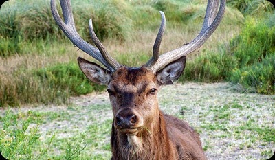 Neuquén is known for the sport hunting of deer and wild boar. This activity is generally practised in ranches near the towns of Junín de los Andes, San Martín de los Andes, Aluminé, and Zapala. There are big game hunting sites in the area of Lanín and Nahuel Huapi National Parks, supervised by professional guides.
In the region, there are three exotic species of deer that can be hunted: red, fallow and axis deer. It is totally forbidden to hunt native species.
4.- Indigenous Peoples: the Toba are considered one of the most important ethnic group called guaycurú.
 The Toba ethnicity in their language called himself ntokóit, then began using the autoetnónimo q'om or Qom (man) and more infrequently by the use of their own language: qom'lek or qom'lik. As usually happens with the spellings of Indian names are many variations in the writing of these words.
The name is a nickname tova Guarani and means "front" because the Qom decalvación often engaged in the front of the scalp, for the same reason the Spanish called them "Frentones" (name also given to similar grounds abipones ). In Paraguay, the name also used emok, Enlhet term meaning neighbor or citizen.
5.- Discover Jujuy: the weather.
 There are 3 main areas in Jujuy; the Altiplano, a 3,500 meters high plateau with peaks of 5,000 meters, covers most of the province.
The Río Grande of Jujuy cuts through the Quebrada de Humahuaca canyon, of heights between 1,000 and 3,500 meters. To the Southeast, the sierras descends to the Gran Chaco region.
6.- Discover Jujuy: Regional Food.
 Our deeply root dishes and meals are an essential part of the culture and tradition of the Province, recipes have been transmitted from generation to generation. You can taste flavors that combine corn, ancestral diet of the Incas, with different meals. Regional and international cuisine can not be rejected.
Tamales, Humitas and Andean preparations will surely be your favourite appetizers, but if your preference is meat, you can enjoy the tasty and healthy meat preparations known in classical or modern, typical of a fusion cuisine
7.- The 10 Most Popular Posts on Argentina Photo Gallery in September 2013.
Carlos Casalla father of legendary cartoon character Cape Savino.
 Father of the legendary cartoon character Cape Savino, settled in Bariloche Casalla fifty years ago. Smart and warm, was the last in his stories in a rigorous manner. The Great Lake, one of his last works, was selected by UNESCO as a reference against discrimination.
8.- Cape Two Bays is considered the most beautiful in the coastal protected areas system.
 Cape Two Bays is considered the most beautiful in the coastal protected area system by contrasting their brownstones landscape and the blue sea.
It has an extraordinary diversity of wildlife is inhabited not only by penguins Magellanic but also seals, guanacos and cormorants, among other wildlife. Some of seabirds that inhabit this place used as the sole breeding site.
9.- Choele Choel is the most important urban center of what is denominated Half Valley.
 Choele Choel was founded July 9 1879 by the general Conrado Villegas in the island Pacheco, with the name Nicolás Avellaneda. It was razed little time later by a flood and the soldiers and their families, next to some civilians, they settled in the well-known place as Pampas de losMolinos, where it remained up to March of l882 18, it dates in that was transferred to their current location.
10.- Las Grutas are located in the Gulf San Matías on the Atlantic coast of the Province of Río Negro
The coast Atlantic rionegrina has three important and outstanding points, one to be a highly converged tourist center, another to be center of the commercial marine fishing, and the third to constitute a fundamental support for the economic activity of the Patagonia. We are speaking of Las Grutas, San Antonio Oeste and Puerto San Antonio,, respectively.
If you liked this article, subscribe to the feed by clicking the image below to keep informed about new contents of the blog:


 Until then, here are our 10 most widely read posts of the year: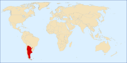


 Patagonia is a geographic region located in the southernmost part of America, comprising areas of southern Argentina and Chile.
  The island of Tierra del Fuego, and sometimes the Falkland Islands, the latter permanently claimed by Argentina, are often included as part of Patagonia.


