09.-La Ruta-40-se-reparte.png

I get up early after sleeping in a school and continue my way through the gravel, the dirt and some strange and inconsistent landscapes for most of the people who believe that Route 40 is just dirt and gravel and roads in poor condition.

Sometimes the adventure happens to observe the beauty that nature offers us and not to suffer the inhospitable conditions of a route.

09.-La Ruta-40.png

Rivers and lagoons along our route. The water runs and the clouds pass.

09.-La Ruta-40-1.png

And signs warning that the road is not always advisable for any type of vehicle.

09.-La Ruta-40-2.png

Purple mountains, yellow stones, chestnut grass and birds that curiously observe the passage of travelers.

09.-La Ruta-40-3.png

While others enjoy the disinterested water of the rest of the world.

09.-La Ruta-40-4.png

Very few vehicles in transit. Some shepherd houses and some new friends we make during the trip. The landscape is quite bleak. Lunch and continue.

09.-La Ruta-40-5.png

I fill the tank of the bike and continue.

09.-La Ruta-40-7.png

The ledge path is narrow and dangerous. You have to be very careful. I come to a place of abandoned houses. I try to stay the night but there is a lot of dirt. I get to the police station and they give me a hand allowing me to camp.

My thanks to them. In these places the police perform a different function, more humanitarian if you want. Stripped of those basic principles of her profession that are preventing crime and sometimes excessive repression. Here they are reserved. And when they can help the traveler they do it.

09.-La Ruta-fin-de-la-segunda-etapa.png

Thank you for reading!

To get more updates you can follow my blogs and / or feel free to follow me on social networks Facebook, Instagram, Medium, Pinterest, Telegram and Twitter.

13.-Esteros-del-Iberà-8-ave.jpg

The Esteros del Iberá constitutes one of the largest and most important wetland macrosystems in Neotropical America, which earned it its designation as a Provincial Reserve.

13.-Esteros-del-Iberà-gavilan-polluelo.jpg

The diet of the sparrowhawk pollero is based mainly on small insects, mammals and reptiles of medium size. They are generally established in extensive mountains, in savannas and lush forests.

Likewise, within this extensive wetland, the second in importance after the Pantanal in Brazil, the Esteros del Iberá National Park has recently been created. With a very rich and varied bird life. Ideal for watching.

13.-Esteros-del-Iberà-21-garza-blanca.jpg

The white heron is large and solitary except when there is concentration of food and it forms groups.

It is also one of the least altered regions of Argentina, preserving threatened species and relatively pristine habitats, although growing and diverse human activities are increasingly impacting the region.

13.-Esteros-del-Iberà-15-boyero.jpg

The boyero is black with an ivory-colored beak and makes its hanging nest, made of woven fibers, shaped like a bag with an upper entrance. Its natural habitat is low forests and tropical or subtropical swampy areas.

The isolation of the contiguous river systems, its exclusive feeding by rains and its location in a transitional region between several biogeographical provinces and between tropical and temperate climates, make Iberá a particular and unique system.

13.-Esteros-del-Iberà-24-bigua-o-cormoran-negro.jpg

The black cormorant is a species found in any large body of water within its global range, including lakes, rivers, estuaries, and coastal waters.

One of the most salient aspects is the number of birds: more than 350 species. A community of birds that presents variations in its composition, richness, abundance and diversity in relation to biogeographic and ecological zones of Iberá.

13.-Esteros-del-Iberà-14-patos-reales.jpg

The mallard duck is a very common and widespread species in all the Esteros del Iberá.

There are some threatened species that have found in this ecosystem the only way to continue subsisting.

There is even an underwater world, despite the depth of the humedial not exceeding two meters, practically unknown.

13.-Esteros-del-Iberà-28-jacana.jpg

The jacaná is a very common marsh bird in the Esteros del Iberá. His toes are so long that he can walk on floating aquatic vegetation without sinking

Plants that continue to grow underwater, unknown fish, a whole underwater world of little depth, but new and fascinating even for science that has studied it very little, dedicating itself above all to underwater life in the oceans and seas.

13.-Esteros-del-Iberà-31-fauna-Ipacaá.jpg

Similar in appearance to a redfish, the Ipacaá is a bird that inhabits the island bush, roaming through swamps and swamps in search of insects, worms, seeds and fruits, which make up a broad, almost omnivorous diet.

Let's see some of the species that we have managed to photograph.

13.-Esteros-del-Iberà-16-bandada-de-patos.jpg

The Esteros del Iberá [Argentina] are a natural paradise for birds.

13.-Esteros-del-Iberà-yetapa-de-collar.jpg

13.-Esteros-del-Iberà-pato-pico-cuchara.jpg

13.-Esteros-del-Iberà-35-garza-overa.jpg

13.-Esteros-del-Iberà-30-ave.jpg

13.-Esteros-del-Iberà-23-ave.jpg

https://steemit.com/hive-148441/@testarasta/the-natural-paradise-of-birds-in-the-esteros-del-ibera-argentina

04.-Calafate-rumbo-al-glaciar.jpg

The word Calafate (actually the correct name is El Calafate) has a special meaning in Argentina.

It is generally identified with the Perito Moreno Glacier, a world wonder, with spectacular ice breaks (the last one was in 2016) that cause a feeling of amazement and disbelief throughout the world.

But in reality Calafate is much more than that. It is the gateway to Los Glaciares National Park, which has tourist attractions of incredible beauty such as the aforementioned Perito Moreno Glacier but also other glaciers such as the Upsala, and Cerro Fitz Roy (also called Chaltén) of which we write in this article.

All of them are located in the so-called eastern region of the Southern Patagonian ice field and border the Torres del Paine National Park in Chile.

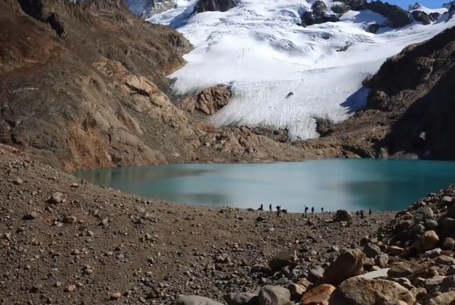
We already talked about the 10-hour excursion that goes from Calafate to the top of Mount Fitz Roy (Chaltén) ​​and the particular charm of Laguna de los Tres up the mountain.

Excursion from Calafate to El Chaltén, 10 hour walk between forests and mountains.

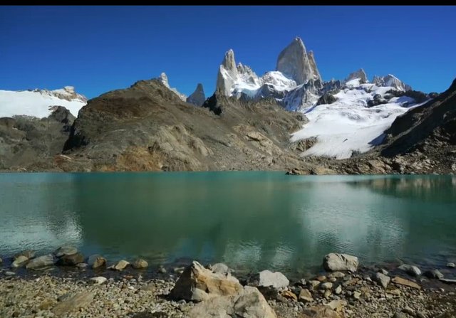
And we also refer to the unique sensation that is experienced when reaching the top of the hill.

Calafate, the reason for the name.

Curious to know the origin of the name, I finally managed to discover it. It is due to a thorny bush endemic to this Patagonian region that receives this name and was used to caulk the old ships that arrived.

That is to say, hemp was used to caulk but as in Patagonia there was no use of this bush called calafate.

At the junction of the woods that formed the case of the ship, a tow was inserted, in this case a caulk embedded in pitch to prevent the entry of water.

This usefulness of the people led her to be considered a true symbol in southern Patagonia.

Heading to the Perito Moreno Glacier.

After resting from the 10-hour hike to reach the top of El Chaltén

From the top of Fitz Roy watching wonderful spectacle.

we rest and get ready for a new adventure: reaching the Perito Moreno Glacier.
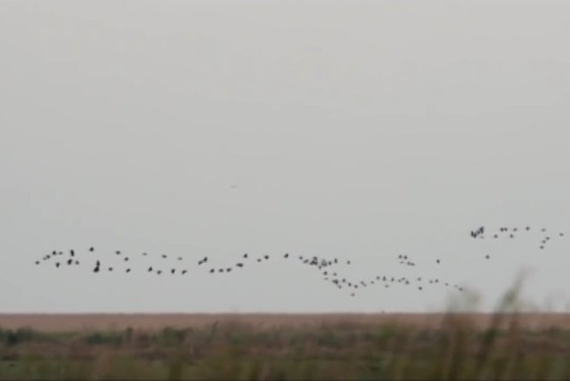
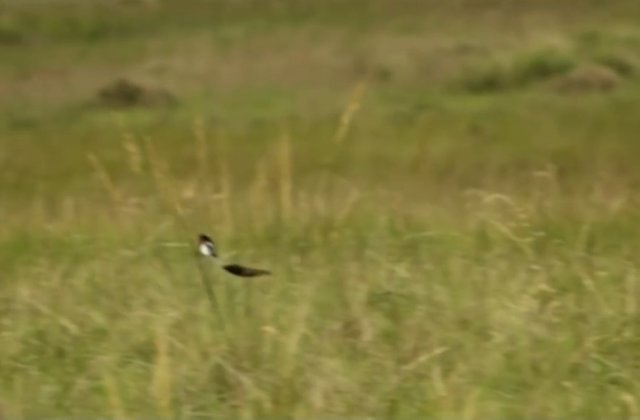
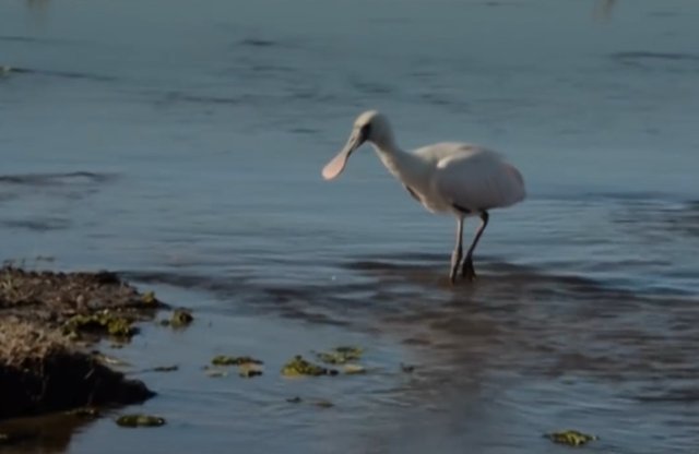
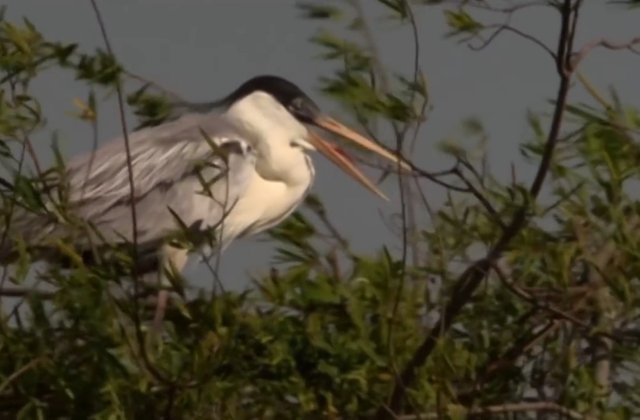
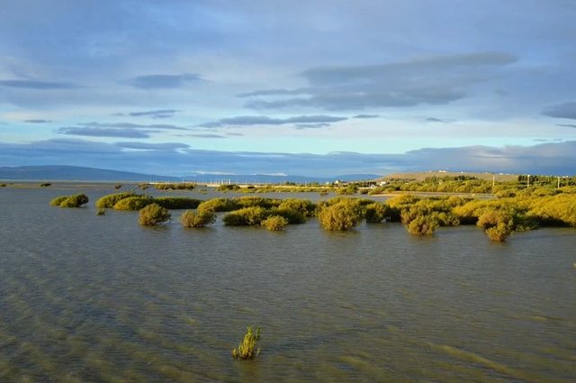
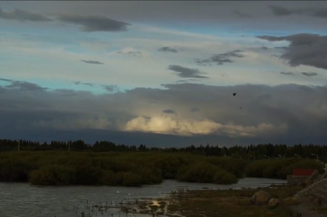
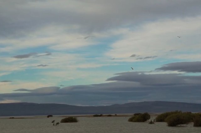
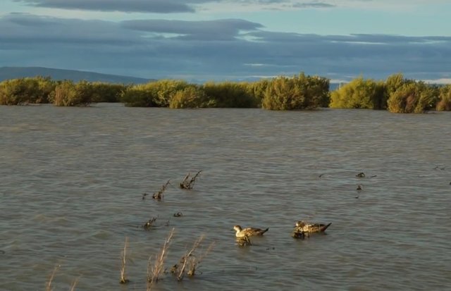
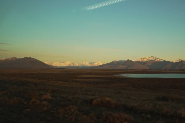
Patagonia, the sunsets with an infinite blue sky that turns into a blood red as the sun goes down and reaches as far as our eyes can see.

Nature in all its splendor.

04.-Calafate-rumbo-al-glaciar-1.jpg

04.-Calafate-rumbo-al-glaciar-2.jpg

04.-Calafate-rumbo-al-glaciar-3.jpg

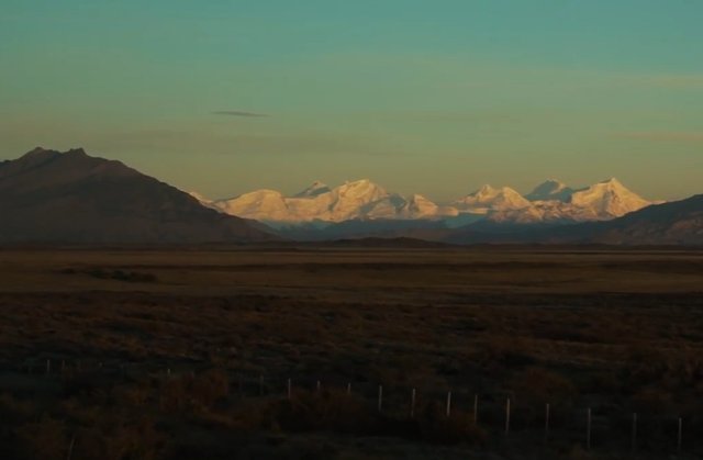
Very early in the morning we start the adventure to discover one of the most surprising places in Argentina: the Perito Moreno Glacier.

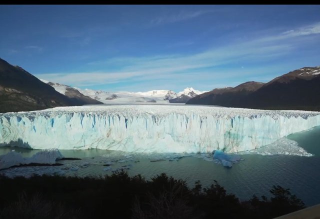
We are approaching the glacier.

04.-Calafate-rumbo-al-glaciar-4.jpg

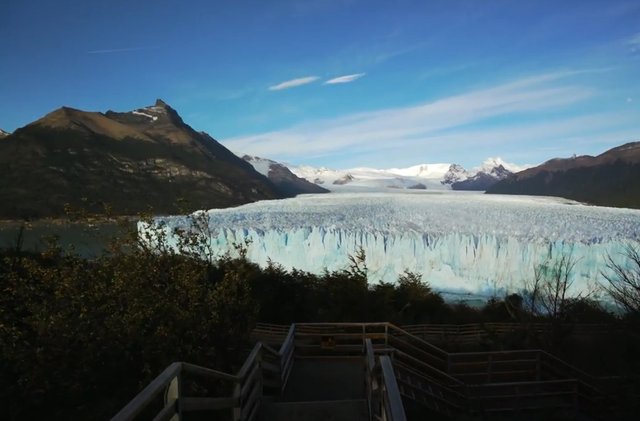
If the glacier is wonderful, the places that we see before filling are not far behind.

04.-Calafate-rumbo-al-glaciar-5.jpg

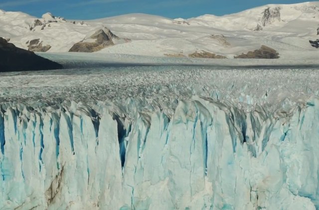
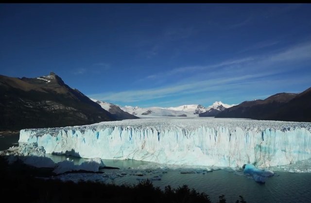
The panoramic image of the glacier is spectacular.

04.-Calafate-rumbo-al-glaciar-6.jpg

04.-Calafate-rumbo-al-glaciar-7.jpg

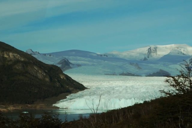
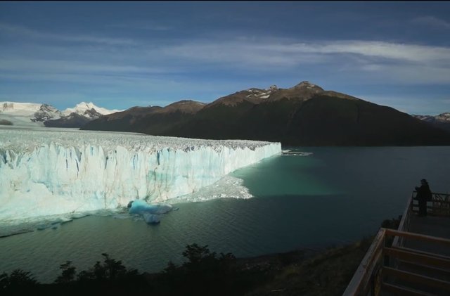
From the viewpoints you can see the beauty of the glacier in all its magnitude.

04.-Calafate-rumbo-al-glaciar-8.jpg

04.-Calafate-rumbo-al-glaciar-9.jpg

04.-Calafate-rumbo-al-glaciar-10.jpg

04.-Calafate-rumbo-al-glaciar-11.jpg

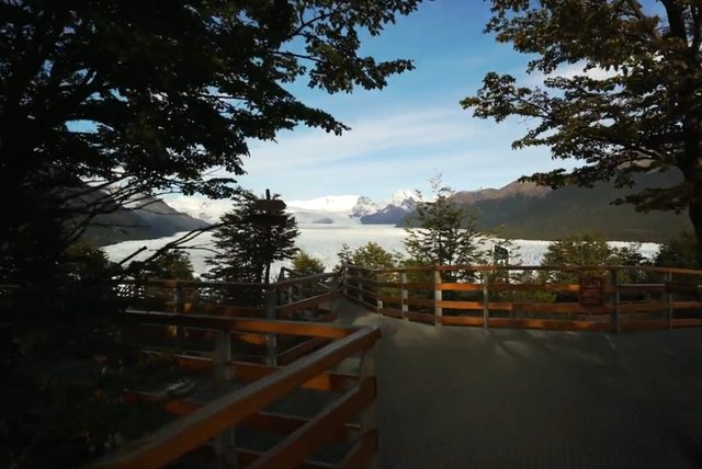
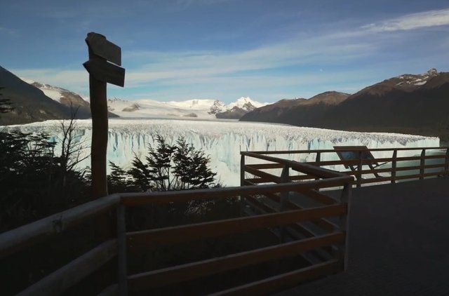
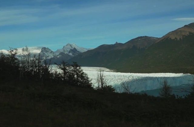
Walking the walkways (viewpoints) along its entire length means getting as close as possible to the glacier.

04.-Calafate-rumbo-al-glaciar-12.jpg

04.-Calafate-rumbo-al-glaciar-13.jpg

04.-Calafate-rumbo-al-glaciar-14.jpg

04.-Calafate-rumbo-al-glaciar-15.jpg

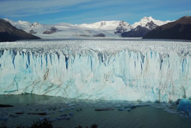
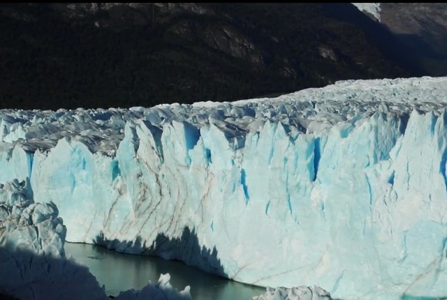
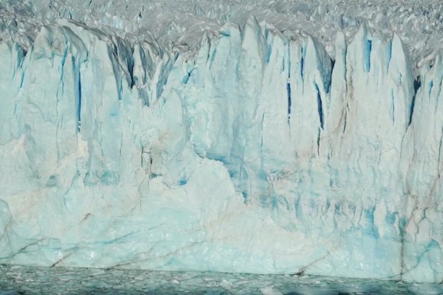
Spectacular view of the glacier walls that can be up to 70 meters high (equivalent to a 25-story building!).

The approximate width of the glacier is 5 kms.

Behind the snowy hills are a postcard.

There are several reasons why the Perito Moreno Glacier is so famous around the world. First, because it is very accessible to reach it by different routes: car, hitchhiking, bus, taxi, tour with agency, etc.

Second because it is one of the few glaciers in the world that is not retreating. In other words, it is quite stable.

And third for its spectacular breaks. In the following image we can see a rupture, although very small, of a part of the glacier.

04.-Calafate-rumbo-al-glaciar-16.jpg

04.-Calafate-rumbo-al-glaciar-17.jpg

04.-Calafate-rumbo-al-glaciar-18.jpg

04.-Calafate-rumbo-al-glaciar-19.jpg

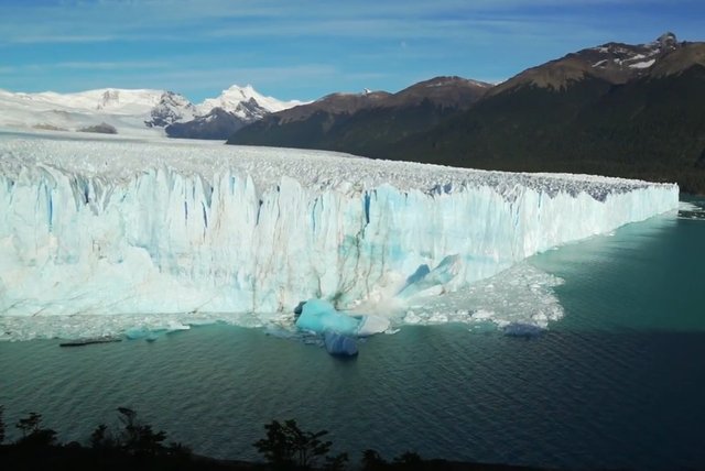
And how it impacts somebody.

04.-Calafate-rumbo-al-glaciar-20.jpg

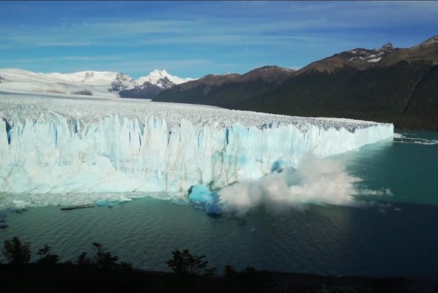
Let's imagine a major glacier break!

It is a special place for many reasons. But having it so close to our walkways with those huge vertical walls is something that steals your heart.

The noise of the glacier crunching the ice blocks is something that scares you and excitement at the same time.

 
Copyright © 2015 Argentina Photo Gallery
Distributed By Gooyaabi Templates
-->